Trail Mountain bike Trets - les contreforts du mont Olympe - Photo
 amiral13
amiral13

User GUIDE

© OpenStreetMap contributors
Length
Length
11.8 km
Max alt
Max alt
647 m
Uphill gradient
Uphill gradient
278 m
Km-Effort
Km-Effort  
15.5 km
Min alt
Min alt
505 m
Downhill gradient
Downhill gradient
279 m
Boucle
Boucle
Yes
Creation date :
2016-12-30 00:00:00.0
Updated on :
2016-12-30 00:00:00.0

(1 Reviews)

Mountain bike
Mountain bike
2h52
Difficulty : Easy

Scan this QR Code to open this trail in the SityTrail application

FREE GPS app for hiking

Logo SityTrail SityTrail

IGN / Geographical institutes

Download SityTrail from the App Store Download SityTrail from Google Play

Logo SityTrail SityTrail World

The world is yours!

Download SityTrail from the App Store Download SityTrail from Google Play Download SityTrail on Huawei AppGallery

About

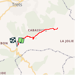
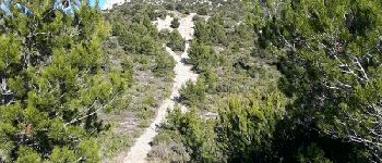
Trail Mountain bike of 11.8 km to be discovered at Provence-Alpes-Côte d'Azur, Bouches-du-Rhône, Trets. This trail is proposed by amiral13.

Description

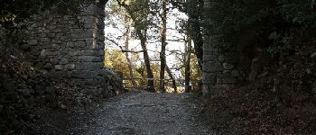
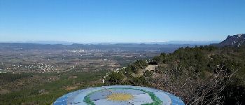
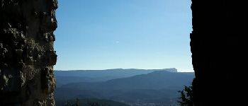
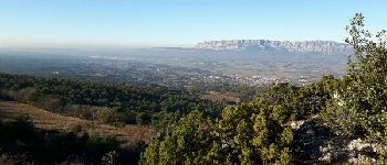
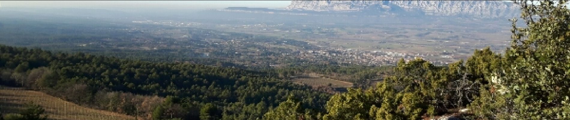
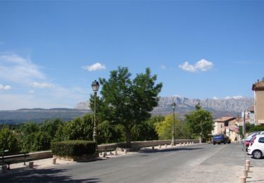
rando VTT facile sur chemin DFCI qui vous aménera du pas de la Couelle au pied du mont Olympe, en passant par l'ermitage de St Jean du Puy (très beau belvédère). pour les courageux un sentier les amènera en 200 m de dénivelée au sommet du mt olympe.

Elevation profile

Photos

Points of interest

Point of interest Trets - les alpes enneigées - Photo
amiral13
Point of interest Trets - la ste Baume - Photo
amiral13
Point of interest Trets - le mont Olympe - Photo
amiral13
Point of interest Trets - la ste Victoire - Photo
amiral13

Positioning

Country:
France
Region :
Provence-Alpes-Côte d'Azur
Department/Province :
Bouches-du-Rhône
Municipality :
Trets
Location:
Unknown
Start:(UTM)
717412 ; 4809912 (31T) N.

Comments

Please log in to post a review or rate the element


à refaire au top


Trails nearby

Trail Walking Peynier - De Peynier aux ruines de Dalbessy - Photo
Walking
ARPF

Walking

Medium
(1)
Peynier, Provence-Alpes-Côte d'Azur, Bouches-du-Rhône, France
8 km | 10.6 km-effort
2h 16min
Yes
Trail Walking Peynier - De Peynier aux ruines de Dalbessy - Photo
Walking
tracegps

Walking

Medium
(2)
Peynier, Provence-Alpes-Côte d'Azur, Bouches-du-Rhône, France
8 km | 10.6 km-effort
2h 0min
Yes
Trail On foot Auriol - Les moulins - Photo
On foot
PRO

On foot

Easy
Auriol, Provence-Alpes-Côte d'Azur, Bouches-du-Rhône, France
3.7 km | 4.2 km-effort
57min
Yes
Trail Walking Saint-Zacharie - Source de l'Huveaune  - Photo
Walking
GUIDE
lhomme.ph

Walking

Easy
Saint-Zacharie, Provence-Alpes-Côte d'Azur, Var, France
15.2 km | 19.7 km-effort
4h 24min
Yes
Trail Walking Trets - Sentier des vignes Trets - Photo
Walking
Elidabeth

Walking

Medium
(1)
Trets, Provence-Alpes-Côte d'Azur, Bouches-du-Rhône, France
13.2 km | 16.9 km-effort
2h 55min
Yes
Trail Walking Trets - SityTrail - mont olympe + crête  - Photo
Walking
frizou83

Walking

Very difficult
(1)
Trets, Provence-Alpes-Côte d'Azur, Bouches-du-Rhône, France
13 km | 21 km-effort
4h 44min
Yes
Trail Walking Trets - Kirbon 2 juin 2022 - Photo
Walking
patzierk

Walking

Difficult
Trets, Provence-Alpes-Côte d'Azur, Bouches-du-Rhône, France
11 km | 16.7 km-effort
7h 41min
Yes
Trail Walking Trets - Kirbon  - Photo
Walking
gaggiroland

Walking

Medium
Trets, Provence-Alpes-Côte d'Azur, Bouches-du-Rhône, France
10.6 km | 14.9 km-effort
3h 30min
No
Trail Walking Saint-Zacharie - St zacharie - Photo
Walking
gaggiroland

Walking

Medium
Saint-Zacharie, Provence-Alpes-Côte d'Azur, Var, France
7 km | 10 km-effort
2h 6min
No


Close
My subscriptions