11.8 km | 15.5 km-effort
Source de l'Huveaune
lhomme.ph
User GUIDE
Length
15.2 km
Max alt
601 m
Uphill gradient
338 m
Km-Effort
19.7 km
Min alt
299 m
Downhill gradient
339 m
Boucle
Yes
Creation date :
2015-03-09 00:00:00.0
Updated on :
2015-03-09 00:00:00.0
4h24
Difficulty : Easy
FREE GPS app for hiking
About
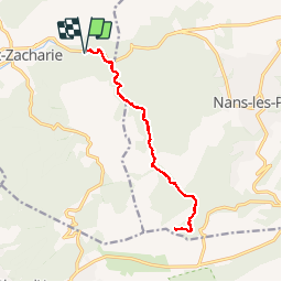
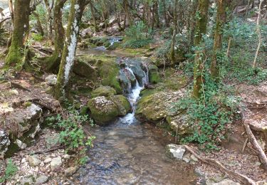
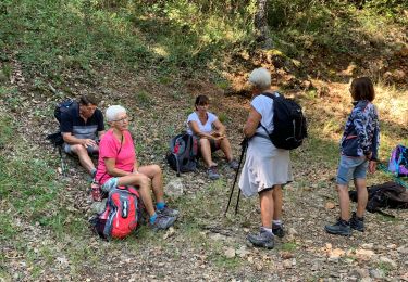
Trail Walking of 15.2 km to be discovered at Provence-Alpes-Côte d'Azur, Var, Saint-Zacharie. This trail is proposed by lhomme.ph.
Description
Attention: Ne pas faire par temps de pluie et si risque d'orage.
Positioning
Country:
France
Region :
Provence-Alpes-Côte d'Azur
Department/Province :
Var
Municipality :
Saint-Zacharie
Location:
Unknown
Start:(Dec)
Start:(UTM)
721146 ; 4807090 (31T) N.
Comments
Trails nearby
les contreforts du mont Olympe
Mountain bike
Easy
(1)
Trets,
Provence-Alpes-Côte d'Azur,
Bouches-du-Rhône,
France
2h 52min
Yes
les sources de l'huveaune
Walking
Very easy
Nans-les-Pins,
Provence-Alpes-Côte d'Azur,
Var,
France
5.8 km | 8.8 km-effort
5h 41min
Yes
Sources des Nayes
Walking
Medium
Saint-Zacharie,
Provence-Alpes-Côte d'Azur,
Var,
France
7.6 km | 9.6 km-effort
1h 47min
Yes
boucle sentier merveilleux 13 km
Walking
Medium
Plan-d'Aups-Sainte-Baume,
Provence-Alpes-Côte d'Azur,
Var,
France
13.4 km | 19.6 km-effort
5h 38min
Yes
l'huveaune
Walking
Very difficult
Plan-d'Aups-Sainte-Baume,
Provence-Alpes-Côte d'Azur,
Var,
France
15.4 km | 25 km-effort
7h 52min
Yes
Nans les pins Viviane
Walking
Medium
Nans-les-Pins,
Provence-Alpes-Côte d'Azur,
Var,
France
14.1 km | 21 km-effort
4h 27min
Yes
L'Huveaune-Nans les pins-06-10-21
On foot
Medium
(2)
Nans-les-Pins,
Provence-Alpes-Côte d'Azur,
Var,
France
15.4 km | 24 km-effort
5h 26min
Yes
St zacharie
Walking
Medium
Saint-Zacharie,
Provence-Alpes-Côte d'Azur,
Var,
France
7 km | 10 km-effort
2h 6min
No
St zacharie
Walking
Easy
Saint-Zacharie,
Provence-Alpes-Côte d'Azur,
Var,
France
10.7 km | 15.2 km-effort
2h 47min
No