


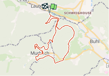
Lautenbach-Col de Schrangen-Murbach-Pont St Barnabé et retour

patrickbeyrath
User

Length
9.8 km

Max alt
555 m

Uphill gradient
423 m
Km-Effort
15.5 km

Min alt
380 m

Downhill gradient
425 m
Boucle
Yes
Creation date :
2018-10-13 05:52:18.504
Updated on :
2018-10-13 05:52:18.515
3h26
Difficulty : Medium

FREE GPS app for hiking
 SityTrail
IGN / Geographical institutes
SityTrail Plus
The world is yours!
About
Trail Walking of 9.8 km to be discovered at Grand Est, Haut-Rhin, Lautenbachzell. This trail is proposed by patrickbeyrath.
Positioning
Country:
France
Region :
Grand Est
Department/Province :
Haut-Rhin
Municipality :
Lautenbachzell
Location:
Unknown
Start:(Dec)
Start:(UTM)
362793 ; 5311096 (32T) N.
Comments