Trail Walking Villiers-sous-Grez - Villiers sous Grez  /  Golfe de Larchant - Photo

Villiers sous Grez / Golfe de Larchant

© OpenStreetMap contributors
Length
Length
18.8 km
Max alt
Max alt
126 m
Uphill gradient
Uphill gradient
304 m
Km-Effort
Km-Effort  
23 km
Min alt
Min alt
68 m
Downhill gradient
Downhill gradient
308 m
Boucle
Boucle
Yes
Creation date :
2018-08-27 14:39:01.096
Updated on :
2019-09-17 07:01:52.305

(1 Reviews)

Walking
Walking
5h03
Difficulty : Medium

Scan this QR Code to open this trail in the SityTrail application

FREE GPS app for hiking

Logo SityTrail SityTrail

IGN / Geographical institutes

Download SityTrail from the App Store Download SityTrail from Google Play

Logo SityTrail SityTrail World

The world is yours!

Download SityTrail from the App Store Download SityTrail from Google Play Download SityTrail on Huawei AppGallery

About

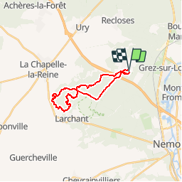
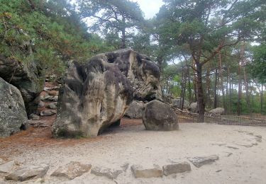
Trail Walking of 18.8 km to be discovered at Ile-de-France, Seine-et-Marne, Villiers-sous-Grez. This trail is proposed by chateau77.

Description

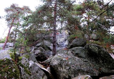
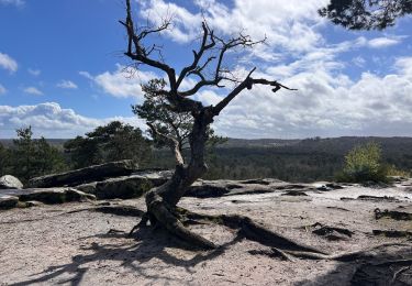
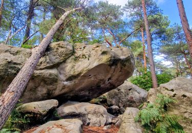
en boucle : Grotte du Curé - Fontaine St Etienne - Grand Fossé - Marais - abris ornés - Croix de la Fontaine St Mathurin - Calvaire des Trois Croix - Croix Bardin - Mont Blanc - Carrière de Blomont - La Fontaine St Bernard - Chalet Jobert

Elevation profile

Positioning

Country:
France
Region :
Ile-de-France
Department/Province :
Seine-et-Marne
Municipality :
Villiers-sous-Grez
Location:
Unknown
Start:(UTM)
474183 ; 5351333 (31U) N.

Comments

Please log in to post a review or rate the element


Trails nearby

Trail On foot Larchant - Sentier Denecourt-Colinet 19 - Photo
On foot
PRO

On foot

Easy
Larchant, Ile-de-France, Seine-et-Marne, France
9.7 km | 12.3 km-effort
2h 47min
Yes
Trail Walking Villiers-sous-Grez - Villiers sous grez / Larchant - Photo
Walking
becor94

Walking

Very difficult
Villiers-sous-Grez, Ile-de-France, Seine-et-Marne, France
24 km | 29 km-effort
5h 31min
Yes
Trail Walking Recloses - Recloses Ve120124 pm - Photo
Walking
fmg

Walking

Medium
(1)
Recloses, Ile-de-France, Seine-et-Marne, France
8.9 km | 10.5 km-effort
2h 23min
Yes
Trail Walking Recloses - Recloses ve 120124 am - Photo
Walking
fmg

Walking

Medium
(1)
Recloses, Ile-de-France, Seine-et-Marne, France
10.8 km | 12.6 km-effort
2h 52min
Yes
Trail Walking Recloses - Boucle recloses Nemours Grez/loing - Photo
Walking
chessyca

Walking

Medium
(1)
Recloses, Ile-de-France, Seine-et-Marne, France
30 km | 34 km-effort
6h 20min
Yes
Trail Walking Larchant - Larchant la Féérique  - Photo
Walking
chessyca

Walking

Medium
Larchant, Ile-de-France, Seine-et-Marne, France
19.6 km | 24 km-effort
5h 14min
Yes
Trail On foot Bourron-Marlotte - Boucle 30 km Bourron Marlotte - Montigny/ Loing / Grez - Photo
On foot
chessyca

On foot

Difficult
Bourron-Marlotte, Ile-de-France, Seine-et-Marne, France
28 km | 32 km-effort
7h 14min
Yes
Trail Walking Recloses - Recloses Ve 280423 SR30042323 PM10km - Photo
Walking
fmg

Walking

Medium
(1)
Recloses, Ile-de-France, Seine-et-Marne, France
9.9 km | 11.9 km-effort
2h 42min
Yes
Trail Walking Fontainebleau - De la mare aux fées à Bourron-Marlotte - Photo
Walking
dmatignon

Walking

Medium
Fontainebleau, Ile-de-France, Seine-et-Marne, France
5.1 km | 6.1 km-effort
2h 0min
Yes


Close
My subscriptions