


les Ubacs et la citadelle

gerard.colonna
User
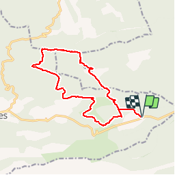

Length
16.3 km

Max alt
709 m

Uphill gradient
414 m
Km-Effort
22 km

Min alt
521 m

Downhill gradient
414 m
Boucle
Yes
Creation date :
2017-01-16 00:00:00.0
Updated on :
2017-01-16 00:00:00.0
5h29
Difficulty : Easy

FREE GPS app for hiking
 SityTrail
IGN / Geographical institutes
SityTrail Plus
The world is yours!
About
Trail Walking of 16.3 km to be discovered at Provence-Alpes-Côte d'Azur, Bouches-du-Rhône, Vauvenargues. This trail is proposed by gerard.colonna.
Positioning
Country:
France
Region :
Provence-Alpes-Côte d'Azur
Department/Province :
Bouches-du-Rhône
Municipality :
Vauvenargues
Location:
Unknown
Start:(Dec)
Start:(UTM)
717039 ; 4825879 (31T) N.
Comments