


gEERSTADEOUESTrs

LouisROGER
User GUIDE
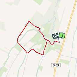

Length
3.1 km

Max alt
392 m

Uphill gradient
31 m
Km-Effort
3.5 km

Min alt
379 m

Downhill gradient
28 m
Boucle
Yes
Creation date :
2017-02-07 00:00:00.0
Updated on :
2017-02-07 00:00:00.0
46m
Difficulty : Unknown

FREE GPS app for hiking
 SityTrail
IGN / Geographical institutes
SityTrail Plus
The world is yours!
About
Trail Walking of 3.1 km to be discovered at New Aquitaine, Pyrénées-Atlantiques, Ger. This trail is proposed by LouisROGER.
Positioning
Country:
France
Region :
New Aquitaine
Department/Province :
Pyrénées-Atlantiques
Municipality :
Ger
Location:
Unknown
Start:(Dec)
Start:(UTM)
739569 ; 4795269 (30T) N.
Comments