Trail Other activity Peyrillac-et-Millac - Atlamed - millac - lacave - Photo

Atlamed - millac - lacave

© OpenStreetMap contributors
Length
Length
19.6 km
Max alt
Max alt
314 m
Uphill gradient
Uphill gradient
334 m
Km-Effort
Km-Effort  
25 km
Min alt
Min alt
88 m
Downhill gradient
Downhill gradient
543 m
Boucle
Boucle
No
Creation date :
2017-02-09 00:00:00.0
Updated on :
2017-02-09 00:00:00.0

(0 Reviews)

Other activity
Other activity
4h08
Difficulty : Very easy

Scan this QR Code to open this trail in the SityTrail application

FREE GPS app for hiking

Logo SityTrail SityTrail

IGN / Geographical institutes

Download SityTrail from the App Store Download SityTrail from Google Play

Logo SityTrail SityTrail World

The world is yours!

Download SityTrail from the App Store Download SityTrail from Google Play Download SityTrail on Huawei AppGallery

About

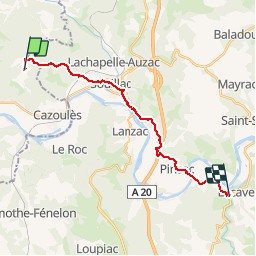
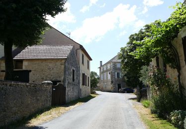
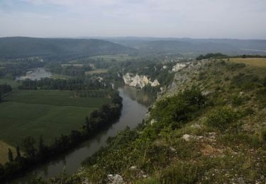
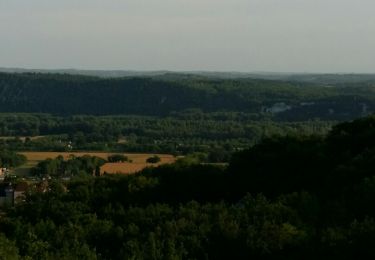
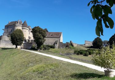
Trail Other activity of 19.6 km to be discovered at New Aquitaine, Dordogne, Peyrillac-et-Millac. This trail is proposed by jbtregouet.

Elevation profile

Photos

Positioning

Country:
France
Region :
New Aquitaine
Department/Province :
Dordogne
Municipality :
Peyrillac-et-Millac
Location:
Unknown
Start:(UTM)
374495 ; 4973537 (31T) N.

Trails nearby

Trail On foot Salignac-Eyvigues - Sentier des Fontaines - Photo
On foot
PRO

On foot

Easy
Salignac-Eyvigues, New Aquitaine, Dordogne, France
3.3 km | 4.8 km-effort
1h 4min
Yes
Trail Running Souillac - Trail chemin d'Enzo - Photo
Running
alain2306

Running

Medium
(1)
Souillac, Occitania, Lot, France
12.8 km | 16.9 km-effort
1h 24min
Yes
Trail Mountain bike Souillac - Transsouillagaise 2013 - Souillac - Photo
Mountain bike
tracegps

Mountain bike

Very difficult
Souillac, Occitania, Lot, France
39 km | 51 km-effort
3h 30min
Yes
Trail Walking Souillac - Souillac_Viaduc - Photo
Walking
GUIDE
jagarnier

Walking

Medium
Souillac, Occitania, Lot, France
12.6 km | 16.3 km-effort
3h 45min
Yes
Trail Road bike Cazoulès - VALLÉE DE LA DORDOGNE- EST DEPUIS  CALVIAC EN PÉRIGORD  - Photo
Road bike
jean-marie.parachini

Road bike

Difficult
Cazoulès, New Aquitaine, Dordogne, France
73 km | 91 km-effort
6h 55min
No
Trail Walking Lanzac - rouffillac - souillac sud part 2 - Photo
Walking
miggi

Walking

Very easy
Lanzac, Occitania, Lot, France
4.8 km | 5.5 km-effort
1h 3min
No
Trail Walking Cazoulès - hauts de Cazoules - Photo
Walking
nicolas93

Walking

Medium
Cazoulès, New Aquitaine, Dordogne, France
17.4 km | 24 km-effort
9h 14min
Yes
Trail Walking Saint-Julien-de-Lampon - St-Julien de Lampon - Photo
Walking
tracegps

Walking

Difficult
Saint-Julien-de-Lampon, New Aquitaine, Dordogne, France
15.1 km | 21 km-effort
3h 0min
Yes
Trail Mountain bike Saint-Julien-de-Lampon - fenelon - Photo
Mountain bike
ra2000

Mountain bike

Medium
Saint-Julien-de-Lampon, New Aquitaine, Dordogne, France
26 km | 33 km-effort
3h 46min
Yes


Close
My subscriptions