


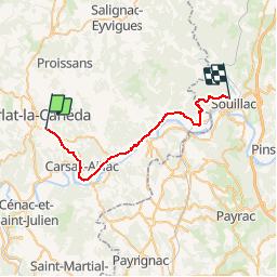
Sarlat La Caneda to Souillac

Mark.Shields
User

Length
31 km

Max alt
300 m

Uphill gradient
497 m
Km-Effort
38 km

Min alt
76 m

Downhill gradient
532 m
Boucle
No
Creation date :
2014-12-10 00:00:00.0
Updated on :
2014-12-10 00:00:00.0
--
Difficulty : Unknown

FREE GPS app for hiking
 SityTrail
IGN / Geographical institutes
SityTrail Plus
The world is yours!
About
Trail Cycle of 31 km to be discovered at New Aquitaine, Dordogne, Sarlat-la-Canéda. This trail is proposed by Mark.Shields.
Description
Sarlat La Caneda to Souillac
Positioning
Country:
France
Region :
New Aquitaine
Department/Province :
Dordogne
Municipality :
Sarlat-la-Canéda
Location:
Unknown
Start:(Dec)
Start:(UTM)
360232 ; 4970533 (31T) N.
Comments