Trail Walking Ligny-lès-Aire - Ligny les aires 12.9Km Dén P 122m - Photo

Ligny les aires 12.9Km Dén P 122m

© OpenStreetMap contributors
Length
Length
12.8 km
Max alt
Max alt
130 m
Uphill gradient
Uphill gradient
122 m
Km-Effort
Km-Effort  
14.5 km
Min alt
Min alt
60 m
Downhill gradient
Downhill gradient
123 m
Boucle
Boucle
Yes
Creation date :
2017-02-22 00:00:00.0
Updated on :
2019-02-04 17:54:08.58

(0 Reviews)

Walking
Walking
2h20
Difficulty : Easy

Scan this QR Code to open this trail in the SityTrail application

FREE GPS app for hiking

Logo SityTrail SityTrail

IGN / Geographical institutes

Download SityTrail from the App Store Download SityTrail from Google Play

Logo SityTrail SityTrail World

The world is yours!

Download SityTrail from the App Store Download SityTrail from Google Play Download SityTrail on Huawei AppGallery

About

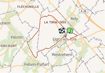
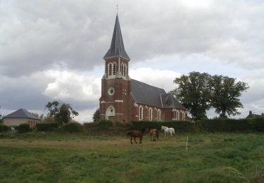
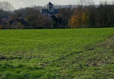
Trail Walking of 12.8 km to be discovered at Hauts-de-France, Pas-de-Calais, Ligny-lès-Aire. This trail is proposed by alain62rando.

Description

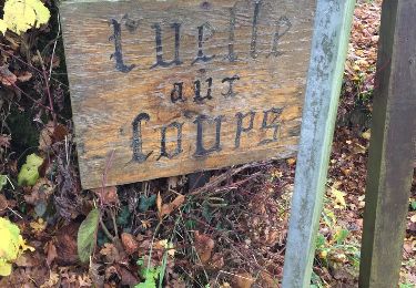
Départ place de la mairie.
Rando avec 8.5Km de chemins.
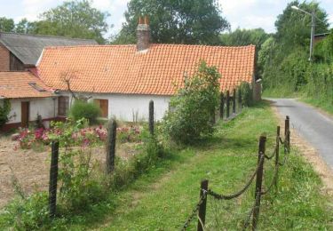
Belle randonnée qui vous fera emprunter un chemin herbeux qui est l'ancienne voie ferrée de l'activité minière d'Estrée-Blanche. Sentier paisible bordé d'espèces arbustives aux essences variées.
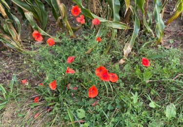
Vous longerez également le Puits sans fond, un petit ruisseau qui prend sa source au hameau d'Honninghem.

Elevation profile

Positioning

Country:
France
Region :
Hauts-de-France
Department/Province :
Pas-de-Calais
Municipality :
Ligny-lès-Aire
Location:
Unknown
Start:(UTM)
454006 ; 5600965 (31U) N.

Trails nearby

Trail Walking Estrée-Blanche - Estrée Blanche - Photo
Walking
Greg813

Walking

Medium
Estrée-Blanche, Hauts-de-France, Pas-de-Calais, France
23 km | 26 km-effort
4h 29min
Yes
Trail Walking Ligny-lès-Aire - Mercredi 16/12/2020 - Photo
Walking
paixdroo

Walking

Very easy
Ligny-lès-Aire, Hauts-de-France, Pas-de-Calais, France
8.6 km | 9.6 km-effort
1h 57min
Yes
Trail Walking Amettes - Amettes - Photo
Walking
delaine

Walking

Very easy
Amettes, Hauts-de-France, Pas-de-Calais, France
11.7 km | 13.6 km-effort
2h 33min
Yes
Trail Other activity Ligny-lès-Aire - Ligny to Ligny - Photo
Other activity
paixdroo

Other activity

Very easy
Ligny-lès-Aire, Hauts-de-France, Pas-de-Calais, France
15.2 km | 17.8 km-effort
3h 35min
Yes
Trail Walking Liettres - Deux jours de randonnée autour d'Aire sur la Lys - Etape 2 - Photo
Walking
tracegps

Walking

Difficult
Liettres, Hauts-de-France, Pas-de-Calais, France
23 km | 26 km-effort
6h 0min
No
Trail Walking Febvin-Palfart - La boucle du puits sans fond - Photo
Walking
tracegps

Walking

Medium
Febvin-Palfart, Hauts-de-France, Pas-de-Calais, France
9.5 km | 11.6 km-effort
2h 15min
Yes
Trail Walking Amettes - Amettes boucle de la coqueline - Photo
Walking
BrassensJC

Walking

Medium
Amettes, Hauts-de-France, Pas-de-Calais, France
8 km | 9.4 km-effort
2h 1min
Yes
Trail Walking Ligny-lès-Aire - Dimanche 21/11/21 - Photo
Walking
paixdroo

Walking

Medium
(1)
Ligny-lès-Aire, Hauts-de-France, Pas-de-Calais, France
6.9 km | 7.7 km-effort
1h 32min
Yes
Trail Walking Ligny-lès-Aire - Ligny les Aire  - Photo
Walking
paixdroo

Walking

Medium
Ligny-lès-Aire, Hauts-de-France, Pas-de-Calais, France
7.9 km | 8.8 km-effort
1h 52min
Yes


Close
My subscriptions