Trail Walking Grandris - Grandris - Photo
 Marfee
Marfee

User

© OpenStreetMap contributors
Length
Length
19.3 km
Max alt
Max alt
869 m
Uphill gradient
Uphill gradient
744 m
Km-Effort
Km-Effort  
29 km
Min alt
Min alt
385 m
Downhill gradient
Downhill gradient
744 m
Boucle
Boucle
Yes
Creation date :
2017-02-27 00:00:00.0
Updated on :
2017-02-27 00:00:00.0

(0 Reviews)

Walking
Walking
5h46
Difficulty : Medium

Scan this QR Code to open this trail in the SityTrail application

FREE GPS app for hiking

Logo SityTrail SityTrail

IGN / Geographical institutes

Download SityTrail from the App Store Download SityTrail from Google Play

Logo SityTrail SityTrail World

The world is yours!

Download SityTrail from the App Store Download SityTrail from Google Play Download SityTrail on Huawei AppGallery

About

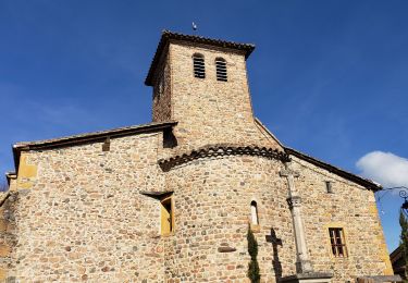
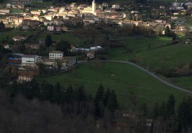
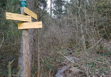
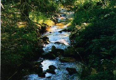
Trail Walking of 19.3 km to be discovered at Auvergne-Rhône-Alpes, Rhône, Grandris. This trail is proposed by Marfee.

Description

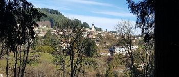
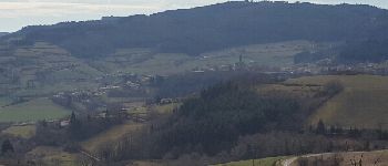
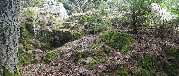
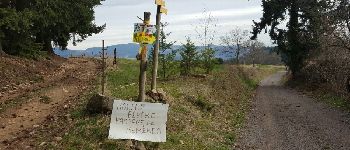
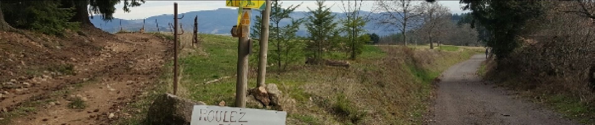
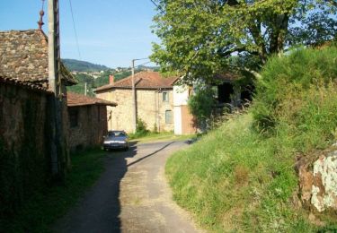
Belle randonnée - parcours agréablement vallonné au milieu des prairies dans une première partie avec de beaux panorama sur les villages et hameaux de la vallée de l'Azergues. Le chemin se poursuit dans la forêt avec quand même quelques échappées qui permettent de découvrir de beaux points de vue. A hauteur du col de la cambuse, vue sur les Alpes. Quelques passages inconfortables pour les pieds (gare à l'entorse !)en particulier quand on quitte le GR pour redescendre sur Grandris.

Elevation profile

Photos

Points of interest

Point of interest Grandris - Point 1 - Photo
Marfee
GRANDRIS 
Point of interest Grandris - Point 5 - Photo
Marfee
GRANDRIS 
Point of interest Cublize - Point 6 - Photo
Marfee
CUBLIZE 
Point of interest Meaux-la-Montagne - Point 7 - Photo
Marfee
MEAUX-LA-MONTAGNE 
Point of interest Saint-Nizier-d'Azergues - mPoint 9 - Photo
Marfee
SAINT-NIZIER-D'AZERGUES 

Positioning

Country:
France
Region :
Auvergne-Rhône-Alpes
Department/Province :
Rhône
Municipality :
Grandris
Location:
Unknown
Start:(UTM)
614086 ; 5099497 (31T) N.

Trails nearby

Trail Walking Saint-Just-d'Avray - Des mollets d'aciers - Saint Just d'Avray - Photo
Walking
tracegps

Walking

Difficult
(2)
Saint-Just-d'Avray, Auvergne-Rhône-Alpes, Rhône, France
10.9 km | 16.5 km-effort
2h 45min
Yes
Trail Walking Chambost-Allières - Chambost avec forêt des expériences et belvédère - Photo
Walking
daniellebou

Walking

Very difficult
(1)
Chambost-Allières, Auvergne-Rhône-Alpes, Rhône, France
18.5 km | 26 km-effort
6h 40min
Yes
Trail Walking Grandris - Grandris  (18 km D. 693 m) - Photo
Walking
Thomasdanielle

Walking

Grandris, Auvergne-Rhône-Alpes, Rhône, France
18.3 km | 27 km-effort
6h 2min
Yes
Trail Walking Lamure-sur-Azergues - Reco rando La Mure sur Azergue - Photo
Walking
Arthurjcm

Walking

Medium
Lamure-sur-Azergues, Auvergne-Rhône-Alpes, Rhône, France
10.7 km | 16.6 km-effort
2h 45min
Yes
Trail Mountain bike Grandris - Espace VTT FFC Pays Beaujolais - Haute Vallée d'Azergues - Circuit n° 06 - Grandis - Photo
Mountain bike
tracegps

Mountain bike

Very difficult
Grandris, Auvergne-Rhône-Alpes, Rhône, France
29 km | 44 km-effort
3h 0min
Yes
Trail Mountain bike Grandris - Espace VTT FFC Pays Beaujolais - Haute Vallée d'Azergues - Circuit n° 05 - Grandis - Photo
Mountain bike
tracegps

Mountain bike

Difficult
Grandris, Auvergne-Rhône-Alpes, Rhône, France
21 km | 32 km-effort
1h 19min
Yes
Trail Mountain bike Grandris - Espace VTT FFC Pays Beaujolais - Haute Vallée d'Azergues - Circuit n° 04 - Grandis - Photo
Mountain bike
tracegps

Mountain bike

Medium
Grandris, Auvergne-Rhône-Alpes, Rhône, France
13.9 km | 19.6 km-effort
1h 0min
Yes
Trail Mountain bike Chambost-Allières - Espace VTT FFC Pays Beaujolais - Haute Vallée d'Azergues - Circuit n° 03 - Chambost Allières - Photo
Mountain bike
tracegps

Mountain bike

Difficult
Chambost-Allières, Auvergne-Rhône-Alpes, Rhône, France
24 km | 35 km-effort
2h 15min
Yes
Trail Mountain bike Chambost-Allières - Espace VTT FFC Pays Beaujolais - Haute Vallée d'Azergues - Circuit n° 02 - Chambost Allières - Photo
Mountain bike
tracegps

Mountain bike

Medium
Chambost-Allières, Auvergne-Rhône-Alpes, Rhône, France
18.4 km | 25 km-effort
2h 0min
Yes


Close
My subscriptions