


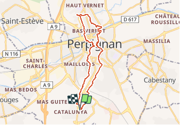
RP66 PERPIGNAN SN + NS porte Espagne à bas Vernet

jeff66
User

Length
16.4 km

Max alt
68 m

Uphill gradient
156 m
Km-Effort
18.5 km

Min alt
21 m

Downhill gradient
156 m
Boucle
Yes
Creation date :
2017-03-09 00:00:00.0
Updated on :
2017-03-09 00:00:00.0
3h01
Difficulty : Medium

FREE GPS app for hiking
 SityTrail
IGN / Geographical institutes
SityTrail Plus
The world is yours!
About
Trail Walking of 16.4 km to be discovered at Occitania, Pyrénées-Orientales, Perpignan. This trail is proposed by jeff66.
Description
RP66 PERPIGNAN SN NS porte Espagne à bas Vernet le 08.03.2017
Positioning
Country:
France
Region :
Occitania
Department/Province :
Pyrénées-Orientales
Municipality :
Perpignan
Location:
Unknown
Start:(Dec)
Start:(UTM)
490605 ; 4723594 (31T) N.
Comments