


BRUNSTATT le long du canal

jmbilger
User

Length
4.7 km

Max alt
255 m

Uphill gradient
22 m
Km-Effort
5 km

Min alt
241 m

Downhill gradient
25 m
Boucle
No
Creation date :
2017-03-13 00:00:00.0
Updated on :
2017-03-13 00:00:00.0
1h03
Difficulty : Very easy

FREE GPS app for hiking
 SityTrail
IGN / Geographical institutes
SityTrail Plus
The world is yours!
About
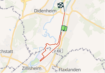
Trail Walking of 4.7 km to be discovered at Grand Est, Haut-Rhin, Brunstatt-Didenheim. This trail is proposed by jmbilger.
Positioning
Country:
France
Region :
Grand Est
Department/Province :
Haut-Rhin
Municipality :
Brunstatt-Didenheim
Location:
Brunstatt
Start:(Dec)
Start:(UTM)
373279 ; 5285413 (32T) N.
Comments