


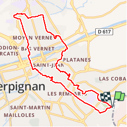
RP66 PERPIGNAN - San Vincens Bas Vernet et retour

jeff66
User

Length
10.9 km

Max alt
53 m

Uphill gradient
86 m
Km-Effort
12.1 km

Min alt
21 m

Downhill gradient
86 m
Boucle
Yes
Creation date :
2017-03-17 00:00:00.0
Updated on :
2017-03-17 00:00:00.0
2h04
Difficulty : Easy

FREE GPS app for hiking
 SityTrail
IGN / Geographical institutes
SityTrail Plus
The world is yours!
About
Trail Walking of 10.9 km to be discovered at Occitania, Pyrénées-Orientales, Perpignan. This trail is proposed by jeff66.
Description
RP66 PERPIGNAN - San Vincens Bas Vernet et retour - le 16.03.2017
Positioning
Country:
France
Region :
Occitania
Department/Province :
Pyrénées-Orientales
Municipality :
Perpignan
Location:
Unknown
Start:(Dec)
Start:(UTM)
493240 ; 4726390 (31T) N.
Comments