


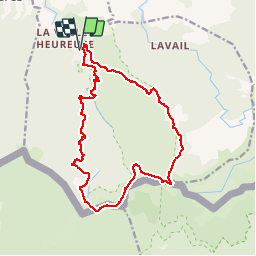
La Farga-Pic des quatre termes -Collada de l'Orri

patbt
User

Length
19.1 km

Max alt
1152 m

Uphill gradient
1082 m
Km-Effort
34 km

Min alt
202 m

Downhill gradient
1083 m
Boucle
Yes
Creation date :
2017-04-09 00:00:00.0
Updated on :
2017-04-09 00:00:00.0
7h04
Difficulty : Difficult

FREE GPS app for hiking
 SityTrail
IGN / Geographical institutes
SityTrail Plus
The world is yours!
About
Trail Walking of 19.1 km to be discovered at Occitania, Pyrénées-Orientales, Sorède. This trail is proposed by patbt.
Positioning
Country:
France
Region :
Occitania
Department/Province :
Pyrénées-Orientales
Municipality :
Sorède
Location:
Unknown
Start:(Dec)
Start:(UTM)
497289 ; 4706078 (31T) N.
Comments