Trail Walking Saint-Martin-en-Vercors - Pas de l'Allier - Photo
 bob2023
bob2023

User

© OpenStreetMap contributors
Length
Length
9.3 km
Max alt
Max alt
1259 m
Uphill gradient
Uphill gradient
411 m
Km-Effort
Km-Effort  
14.8 km
Min alt
Min alt
999 m
Downhill gradient
Downhill gradient
414 m
Boucle
Boucle
Yes
Creation date :
2018-08-26 08:32:04.706
Updated on :
2018-08-26 08:32:04.724

(0 Reviews)

Walking
Walking
3h12
Difficulty : Medium

Scan this QR Code to open this trail in the SityTrail application

FREE GPS app for hiking

Logo SityTrail SityTrail

IGN / Geographical institutes

Download SityTrail from the App Store Download SityTrail from Google Play

Logo SityTrail SityTrail World

The world is yours!

Download SityTrail from the App Store Download SityTrail from Google Play Download SityTrail on Huawei AppGallery

About

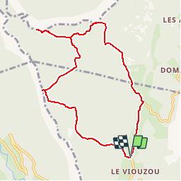
Trail Walking of 9.3 km to be discovered at Auvergne-Rhône-Alpes, Drôme, Saint-Martin-en-Vercors. This trail is proposed by bob2023.

Description

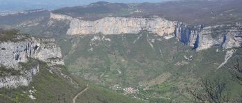
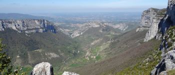
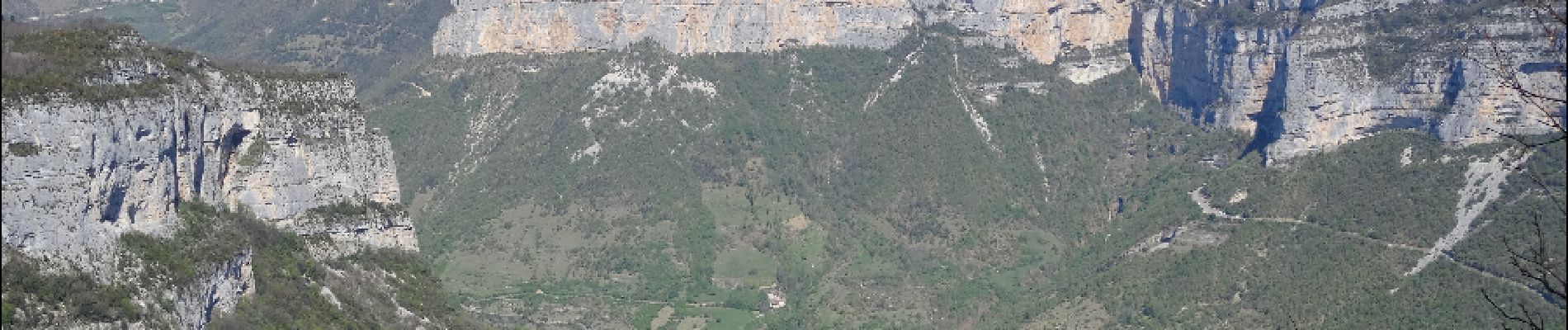
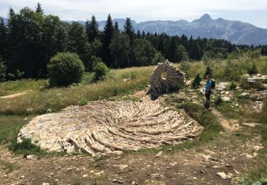
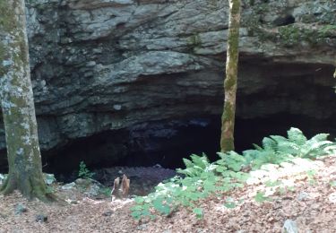
Magnifique randonnée qui vous fera découvrir de beaux points de vue sur Combe Laval et les Gorges de la Bourne (à gauche à la punaise bleue).
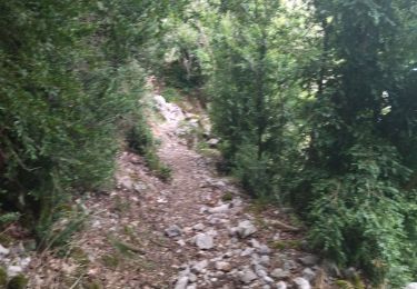
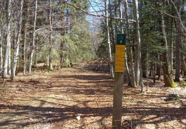
Cette randonnée ne présente aucune difficulté. les forêts traversées sont magnifiques. Les points de vue très beaux. Les sentiers sont bien entretenus et le dénivelé se fait peu sentir.
bonne randonnée.

Elevation profile

Photos

Points of interest

Point of interest Châtelus - Magnifique point de vue - Photo
bob2023
Point of interest Saint-Julien-en-Vercors - Deux possibilités - Photo
bob2023
SAINT-JULIEN-EN-VERCORS 
Point of interest Châtelus - Deux choix - Photo
bob2023
CHÂTELUS 
Point of interest Saint-Martin-en-Vercors - Pas de l'Allier - Photo
bob2023
SAINT-MARTIN-EN-VERCORS 

Positioning

Country:
France
Region :
Auvergne-Rhône-Alpes
Department/Province :
Drôme
Municipality :
Saint-Martin-en-Vercors
Location:
Unknown
Start:(UTM)
690759 ; 4988202 (31T) N.

Trails nearby

Trail Walking La Chapelle-en-Vercors - Belvedere de la Révoulat - Photo
Walking
simon.paume

Walking

Easy
(1)
La Chapelle-en-Vercors, Auvergne-Rhône-Alpes, Drôme, France
5.3 km | 10.6 km-effort
2h 5min
Yes
Trail Walking Châtelus - Boucle Pas de l'Allier - Pas des Voutes - Photo
Walking
tracegps

Walking

Medium
(1)
Châtelus, Auvergne-Rhône-Alpes, Isère, France
10.1 km | 22 km-effort
4h 30min
Yes
Trail Other activity Saint-Martin-en-Vercors - Cournouses pas de l'allier - Photo
Other activity
collot

Other activity

Medium
(1)
Saint-Martin-en-Vercors, Auvergne-Rhône-Alpes, Drôme, France
11 km | 21 km-effort
5h 0min
Yes
Trail Walking Saint-Laurent-en-Royans - 26 rocher des mines ARP - Photo
Walking
himba26100

Walking

Very difficult
Saint-Laurent-en-Royans, Auvergne-Rhône-Alpes, Drôme, France
8.6 km | 16.2 km-effort
6h 53min
Yes
Trail Walking Châtelus - 38 pabro charmatte - Photo
Walking
himba26100

Walking

Difficult
Châtelus, Auvergne-Rhône-Alpes, Isère, France
11.4 km | 29 km-effort
7h 43min
Yes
Trail Walking Saint-Martin-en-Vercors - La Sambue et le belvedere de Chateau Julien - Photo
Walking
ajd26

Walking

Very difficult
Saint-Martin-en-Vercors, Auvergne-Rhône-Alpes, Drôme, France
15.7 km | 24 km-effort
5h 27min
Yes
Trail Walking Saint-Martin-en-Vercors - Pas st Martin - Photo
Walking
crocau

Walking

Very easy
Saint-Martin-en-Vercors, Auvergne-Rhône-Alpes, Drôme, France
4.9 km | 6.9 km-effort
2h 34min
Yes
Trail Walking Saint-Martin-en-Vercors - grotte de la cheminée  - Photo
Walking
cousam

Walking

Medium
Saint-Martin-en-Vercors, Auvergne-Rhône-Alpes, Drôme, France
8.4 km | 12.4 km-effort
4h 34min
Yes
Trail Walking Saint-Julien-en-Vercors - Pas des Voutes-Pas de l'Allier depuis St Julien en Vercors - Photo
Walking
crocau

Walking

Easy
Saint-Julien-en-Vercors, Auvergne-Rhône-Alpes, Drôme, France
11.3 km | 17.8 km-effort
3h 31min
Yes


Close
My subscriptions