


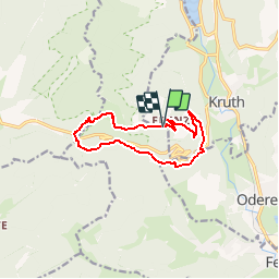
2017 04 rando pedestre Kruth 2

staubalex
User

Length
10.4 km

Max alt
1084 m

Uphill gradient
579 m
Km-Effort
18.1 km

Min alt
548 m

Downhill gradient
565 m
Boucle
Yes
Creation date :
2017-04-17 00:00:00.0
Updated on :
2017-04-17 00:00:00.0
3h46
Difficulty : Easy

FREE GPS app for hiking
 SityTrail
IGN / Geographical institutes
SityTrail Plus
The world is yours!
About
Trail Walking of 10.4 km to be discovered at Grand Est, Haut-Rhin, Kruth. This trail is proposed by staubalex.
Positioning
Country:
France
Region :
Grand Est
Department/Province :
Haut-Rhin
Municipality :
Kruth
Location:
Unknown
Start:(Dec)
Start:(UTM)
346488 ; 5310081 (32T) N.
Comments