


voie verte retour

bert16
User

Length
23 km

Max alt
128 m

Uphill gradient
207 m
Km-Effort
26 km

Min alt
71 m

Downhill gradient
189 m
Boucle
No
Creation date :
2017-04-26 00:00:00.0
Updated on :
2017-04-26 00:00:00.0
1h41
Difficulty : Easy

FREE GPS app for hiking
 SityTrail
IGN / Geographical institutes
SityTrail Plus
The world is yours!
About
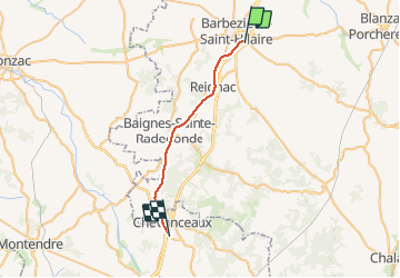
Trail Cycle of 23 km to be discovered at New Aquitaine, Charente, Barbezieux-Saint-Hilaire. This trail is proposed by bert16.
Description
barbezieux chevanceaux
Positioning
Country:
France
Region :
New Aquitaine
Department/Province :
Charente
Municipality :
Barbezieux-Saint-Hilaire
Location:
Unknown
Start:(Dec)
Start:(UTM)
723292 ; 5038048 (30T) N.
Comments