


La Madone Mt Fracha Arsilane

GrouGary
User
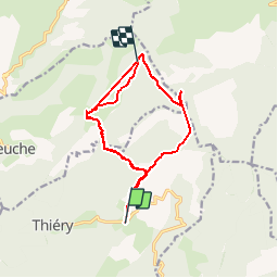

Length
18.8 km

Max alt
1726 m

Uphill gradient
1341 m
Km-Effort
36 km

Min alt
1071 m

Downhill gradient
1092 m
Boucle
No
Creation date :
2017-05-03 00:00:00.0
Updated on :
2017-05-03 00:00:00.0
6h14
Difficulty : Medium

FREE GPS app for hiking
 SityTrail
IGN / Geographical institutes
SityTrail Plus
The world is yours!
About
Trail Walking of 18.8 km to be discovered at Provence-Alpes-Côte d'Azur, Maritime Alps, Thiéry. This trail is proposed by GrouGary.
Description
Bon balisage. Grosse chaleur Arsilane à la Madone (talweg étroit. Nombreuses pertes de navigation dans la forêt.
Positioning
Country:
France
Region :
Provence-Alpes-Côte d'Azur
Department/Province :
Maritime Alps
Municipality :
Thiéry
Location:
Unknown
Start:(Dec)
Start:(UTM)
343845 ; 4871355 (32T) N.
Comments