Trail Walking Aiguines - Aiguines Le Grand Margès rando  - Photo

Aiguines Le Grand Margès rando

 Sugg
Sugg

User

© OpenStreetMap contributors
Length
Length
10.2 km
Max alt
Max alt
1570 m
Uphill gradient
Uphill gradient
617 m
Km-Effort
Km-Effort  
18.8 km
Min alt
Min alt
840 m
Downhill gradient
Downhill gradient
735 m
Boucle
Boucle
No
Creation date :
2019-03-22 16:58:25.936
Updated on :
2019-03-22 16:58:26.024

(0 Reviews)

Walking
Walking
5h00
Difficulty : Medium

Scan this QR Code to open this trail in the SityTrail application

FREE GPS app for hiking

Logo SityTrail SityTrail

IGN / Geographical institutes

Download SityTrail from the App Store Download SityTrail from Google Play

Logo SityTrail SityTrail World

The world is yours!

Download SityTrail from the App Store Download SityTrail from Google Play Download SityTrail on Huawei AppGallery

About

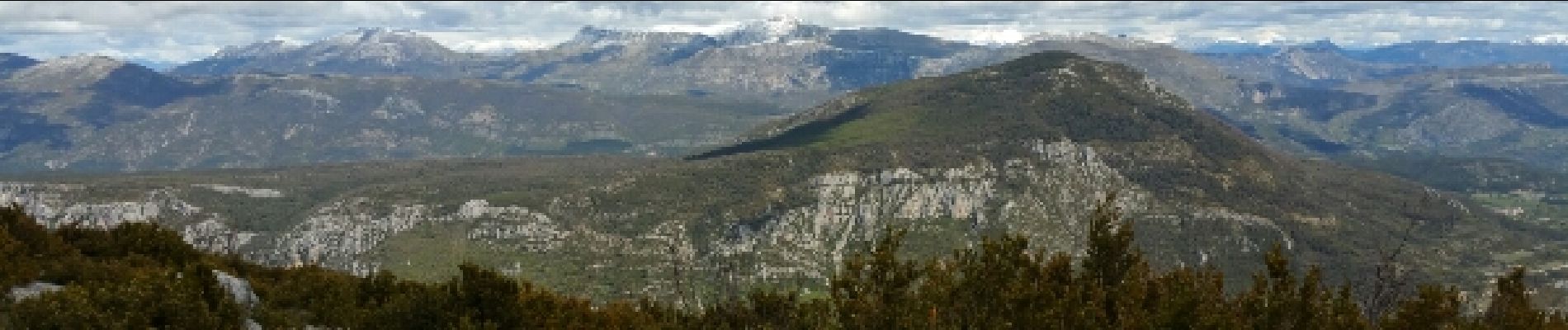
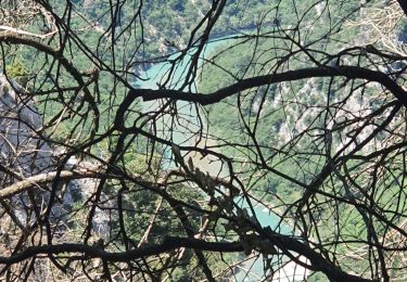
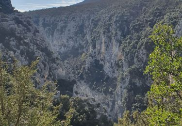
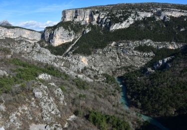
Trail Walking of 10.2 km to be discovered at Provence-Alpes-Côte d'Azur, Var, Aiguines. This trail is proposed by Sugg.

Description

Avec Pierre,
Un aller simple depuis La Petite Forêt,grâce à un mouvement de véhicules.La montée au Pas de Garimbau pour s'échauffer, pic nic dans la doline avant le sommet en 1576.
Quelques traces de neige dans les endroits à l'ombre, et retour pas facile, sentier assez technique rendu délicat avec la boue et l'humidité sur les rochers, pas simple pour certains de nos anciens.
Belle journée, malgré la menace d'orage se profilant à l'horizon.
PS : la distance ne reflète pas la réalité de l'effort suite au dénivelé et la qualité du sentier.)

Elevation profile

Photos

Positioning

Country:
France
Region :
Provence-Alpes-Côte d'Azur
Department/Province :
Var
Municipality :
Aiguines
Location:
Unknown
Start:(UTM)
282855 ; 4848107 (32T) N.

Trails nearby

Trail Walking Aiguines - Belvédère, gorges, Inbut, sentier Vidal - Photo
Walking
MarcLEBARON

Walking

Difficult
(3)
Aiguines, Provence-Alpes-Côte d'Azur, Var, France
9.3 km | 20 km-effort
3h 35min
Yes
Trail Walking La Palud-sur-Verdon - Sentier Blanc-Martel - Photo
Walking
i20

Walking

Medium
(2)
La Palud-sur-Verdon, Provence-Alpes-Côte d'Azur, Alpes-de-Haute-Provence, France
15.4 km | 31 km-effort
Unknown
No
Trail Walking Aiguines - 25-07-2023 Le Grand Margès retour par le cirque de Vaumale - Photo
Walking
GUIDE
Kargil

Walking

Very difficult
Aiguines, Provence-Alpes-Côte d'Azur, Var, France
17 km | 31 km-effort
7h 5min
Yes
Trail Walking La Palud-sur-Verdon - Verdon : Sentier Blanc Martel - Photo
Walking
manumax

Walking

Medium
(1)
La Palud-sur-Verdon, Provence-Alpes-Côte d'Azur, Alpes-de-Haute-Provence, France
16.1 km | 39 km-effort
6h 43min
No
Trail Walking La Palud-sur-Verdon - bastidon - Photo
Walking
xav34830

Walking

Medium
(1)
La Palud-sur-Verdon, Provence-Alpes-Côte d'Azur, Alpes-de-Haute-Provence, France
18.4 km | 33 km-effort
Unknown
Yes
Trail Walking La Palud-sur-Verdon - Sentier des Pêcheurs - Photo
Walking
frizou83

Walking

Easy
(2)
La Palud-sur-Verdon, Provence-Alpes-Côte d'Azur, Alpes-de-Haute-Provence, France
5.8 km | 10.3 km-effort
2h 30min
Yes
Trail Walking Aiguines - aiguines - Photo
Walking
mailis

Walking

Very easy
(2)
Aiguines, Provence-Alpes-Côte d'Azur, Var, France
6.6 km | 10.8 km-effort
2h 35min
Yes
Trail Walking La Palud-sur-Verdon - 2024-06-02 Bastidon - Graou - Photo
Walking
GUIDE
Kargil

Walking

Very difficult
La Palud-sur-Verdon, Provence-Alpes-Côte d'Azur, Alpes-de-Haute-Provence, France
16.8 km | 29 km-effort
6h 34min
Yes
Trail Walking La Palud-sur-Verdon - Chalet de la Maline - Point Sublime - Photo
Walking
LtZIP

Walking

Very difficult
La Palud-sur-Verdon, Provence-Alpes-Côte d'Azur, Alpes-de-Haute-Provence, France
14.4 km | 28 km-effort
6h 19min
No


Close
My subscriptions