Trail Walking M'Semrir - Oussikis, Maroc, avril 2017 - Photo
© OpenStreetMap contributors
Length
Length
7.4 km
Max alt
Max alt
2303 m
Uphill gradient
Uphill gradient
349 m
Km-Effort
Km-Effort  
12 km
Min alt
Min alt
2017 m
Downhill gradient
Downhill gradient
348 m
Boucle
Boucle
Yes
Creation date :
2018-11-11 15:19:54.939
Updated on :
2018-11-11 18:39:08.267

(0 Reviews)

Walking
Walking
2h37
Difficulty : Medium

Scan this QR Code to open this trail in the SityTrail application

FREE GPS app for hiking

Logo SityTrail SityTrail

IGN / Geographical institutes

Download SityTrail from the App Store Download SityTrail from Google Play

Logo SityTrail SityTrail World

The world is yours!

Download SityTrail from the App Store Download SityTrail from Google Play Download SityTrail on Huawei AppGallery

About

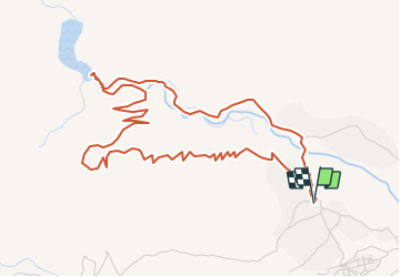
Trail Walking of 7.4 km to be discovered at Drâa-Tafilalet, cercle de Boulmane-Dadès, M'Semrir. This trail is proposed by annefrance70.

Description

montée sur le sommet du village d’oussikis, decente vers le barrage et retour le long de l’oued jusqu’au village.

Elevation profile

Positioning

Country:
Morocco
Region :
Drâa-Tafilalet
Department/Province :
cercle de Boulmane-Dadès
Municipality :
M'Semrir
Location:
Unknown
Start:(UTM)
225995 ; 3509647 (30R) N.

Trails nearby

Trail Walking Zaouiat Ahansal - zaouiat ahansal-avril 2017 - Photo
Walking
annefrance70

Walking

Easy
Zaouiat Ahansal, Béni Mellal-Khénifra, cercle d'Azilal, Morocco
17.3 km | 26 km-effort
5h 50min
Yes


Close
My subscriptions