


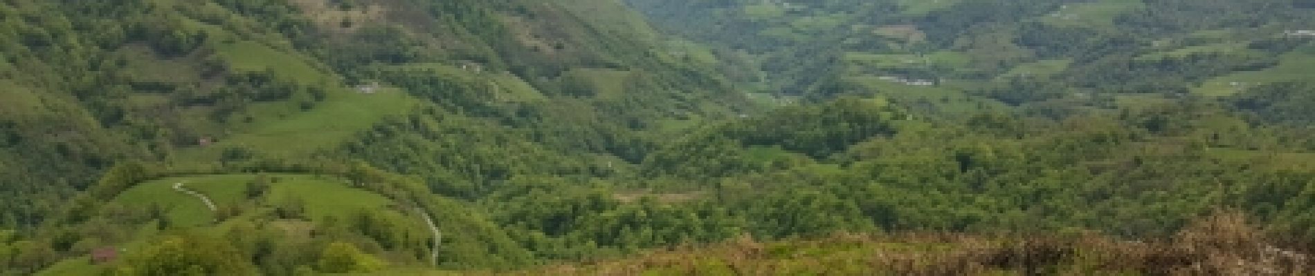
TDP N°7 COL de L'IRAU LARRAU

jeff2
User
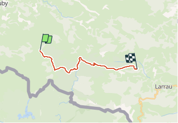

Length
17.7 km

Max alt
1454 m

Uphill gradient
984 m
Km-Effort
32 km

Min alt
702 m

Downhill gradient
1269 m
Boucle
No
Creation date :
2017-05-10 00:00:00.0
Updated on :
2017-05-10 00:00:00.0
6h31
Difficulty : Unknown

FREE GPS app for hiking
 SityTrail
IGN / Geographical institutes
SityTrail Plus
The world is yours!
About
Trail Other activity of 17.7 km to be discovered at New Aquitaine, Pyrénées-Atlantiques, Lecumberry. This trail is proposed by jeff2.
Description
Problème sur Sitytrail sur les 3 derniers kilometres
Photos


Positioning
Country:
France
Region :
New Aquitaine
Department/Province :
Pyrénées-Atlantiques
Municipality :
Lecumberry
Location:
Unknown
Start:(Dec)
Start:(UTM)
652477 ; 4768703 (30T) N.
Comments