


Etangs de Lacham Favars

houbart
User
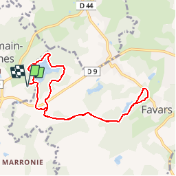

Length
8.8 km

Max alt
439 m

Uphill gradient
175 m
Km-Effort
11.2 km

Min alt
392 m

Downhill gradient
175 m
Boucle
Yes
Creation date :
2019-03-28 15:47:13.413
Updated on :
2019-03-28 15:47:13.453
2h26
Difficulty : Unknown

FREE GPS app for hiking
 SityTrail
IGN / Geographical institutes
SityTrail Plus
The world is yours!
About
Trail Walking of 8.8 km to be discovered at New Aquitaine, Corrèze, Saint-Germain-les-Vergnes. This trail is proposed by houbart.
Description
Départ près du centre équestre de St Germain les Vergnes.
Positioning
Country:
France
Region :
New Aquitaine
Department/Province :
Corrèze
Municipality :
Saint-Germain-les-Vergnes
Location:
Unknown
Start:(Dec)
Start:(UTM)
393748 ; 5013488 (31T) N.
Comments