


TDP N°11 BORCE GABAS

jeff2
User
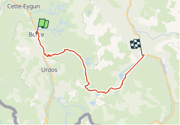

Length
26 km

Max alt
2189 m

Uphill gradient
2239 m
Km-Effort
55 km

Min alt
595 m

Downhill gradient
1852 m
Boucle
No
Creation date :
2017-05-15 00:00:00.0
Updated on :
2017-05-15 00:00:00.0
8h31
Difficulty : Unknown

FREE GPS app for hiking
 SityTrail
IGN / Geographical institutes
SityTrail Plus
The world is yours!
About
Trail Other activity of 26 km to be discovered at New Aquitaine, Pyrénées-Atlantiques, Borce. This trail is proposed by jeff2.
Description
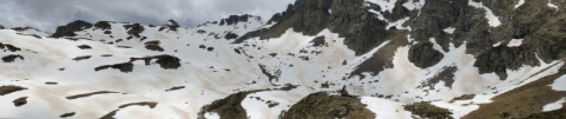
Gros dénivelé
Photos


21 photos in total. Please click on a photo to see them all in the gallery.


Positioning
Country:
France
Region :
New Aquitaine
Department/Province :
Pyrénées-Atlantiques
Municipality :
Borce
Location:
Unknown
Start:(Dec)
Start:(UTM)
698160 ; 4753459 (30T) N.
Comments