Trail Other activity Rupt-sur-Moselle - BELUE - Photo
© OpenStreetMap contributors
Length
Length
10.9 km
Max alt
Max alt
872 m
Uphill gradient
Uphill gradient
476 m
Km-Effort
Km-Effort  
17.2 km
Min alt
Min alt
422 m
Downhill gradient
Downhill gradient
475 m
Boucle
Boucle
Yes
Creation date :
2017-05-17 00:00:00.0
Updated on :
2017-05-17 00:00:00.0

(0 Reviews)

Other activity
Other activity
2h53
Difficulty : Unknown

Scan this QR Code to open this trail in the SityTrail application

FREE GPS app for hiking

Logo SityTrail SityTrail

IGN / Geographical institutes

Download SityTrail from the App Store Download SityTrail from Google Play

Logo SityTrail SityTrail World

The world is yours!

Download SityTrail from the App Store Download SityTrail from Google Play Download SityTrail on Huawei AppGallery

About

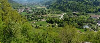
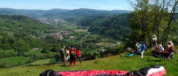
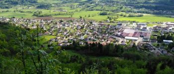
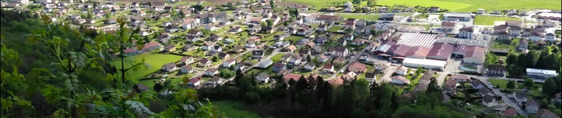
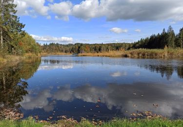
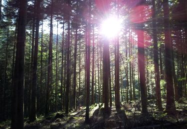
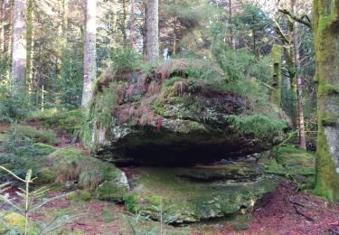
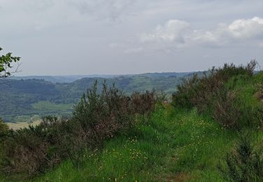
Trail Other activity of 10.9 km to be discovered at Grand Est, Vosges, Rupt-sur-Moselle. This trail is proposed by jeanclaude12.

Description

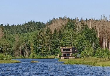
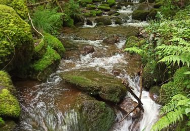
Belle randonnée avec plusieurs points de vue sur la Vallée de la Moselle, les sommets ouest du Massif Vosgien et de  la Haute-Saône.

Elevation profile

Photos

Points of interest

Point of interest Rupt-sur-Moselle - La Miche de Pain - Photo
jeanclaude12
RUPT-SUR-MOSELLE 
Point of interest Rupt-sur-Moselle - Point d'envol parapente - Photo
jeanclaude12
RUPT-SUR-MOSELLE 
Point of interest Rupt-sur-Moselle - Croix de Parier - Photo
jeanclaude12
RUPT-SUR-MOSELLE 
Point of interest Rupt-sur-Moselle - Point 4 - Photo
jeanclaude12
RUPT-SUR-MOSELLE 

Positioning

Country:
France
Region :
Grand Est
Department/Province :
Vosges
Municipality :
Rupt-sur-Moselle
Location:
Unknown
Start:(UTM)
325251 ; 5310765 (32T) N.

Trails nearby

Trail Walking Vecoux - Chalet avuxon / La Vrille / Col de Xiard variante - Photo
Walking
Emmanuel Remy

Walking

Very difficult
(1)
Vecoux, Grand Est, Vosges, France
12.3 km | 19.1 km-effort
4h 20min
Yes
Trail Walking Corravillers - 08-10-22 - Photo
Walking
annefrance70

Walking

Easy
Corravillers, Bourgogne-Franche-Comté, Haute-Saône, France
5.6 km | 7.4 km-effort
1h 44min
Yes
Trail On foot Girmont-Val-d'Ajol - La Beuille, sur la ligne de partage des eaux - Photo
On foot
PRO

On foot

Easy
(1)
Girmont-Val-d'Ajol, Grand Est, Vosges, France
8.7 km | 12.1 km-effort
2h 45min
Yes
Trail Walking Rupt-sur-Moselle - Vosges 2019 : réserve de Rupt-sur-Moselle.ori - Photo
Walking
PatDev

Walking

Medium
Rupt-sur-Moselle, Grand Est, Vosges, France
11.4 km | 17.7 km-effort
5h 13min
Yes
Trail Walking Rupt-sur-Moselle - 21-05-23 autour du chalet de Belué - Photo
Walking
annefrance70

Walking

Medium
Rupt-sur-Moselle, Grand Est, Vosges, France
3.8 km | 5.3 km-effort
1h 1min
Yes
Trail Walking La Montagne - 29-04-23 tour de Giraultfahys et étangs - Photo
Walking
annefrance70

Walking

Medium
La Montagne, Bourgogne-Franche-Comté, Haute-Saône, France
10 km | 13.1 km-effort
2h 40min
Yes
Trail Walking Ferdrupt - 27-02-22 rando raclette chalet Linqueny- chalet de l'alouette - Photo
Walking
annefrance70

Walking

Easy
Ferdrupt, Grand Est, Vosges, France
9.4 km | 12.6 km-effort
3h 58min
Yes
Trail Walking Corravillers - 18-07-21  - Photo
Walking
annefrance70

Walking

Easy
Corravillers, Bourgogne-Franche-Comté, Haute-Saône, France
8.5 km | 11.5 km-effort
2h 14min
Yes
Trail Walking Vecoux - 07-06-21 Reherrey- chalet des meules- col de xiard- chalet de l'avuxon- source chaude - Photo
Walking
annefrance70

Walking

Medium
(1)
Vecoux, Grand Est, Vosges, France
19.7 km | 28 km-effort
5h 18min
Yes


Close
My subscriptions