


Vignols : Peyrade - Noux

houbart
User
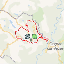

Length
6.1 km

Max alt
382 m

Uphill gradient
170 m
Km-Effort
8.3 km

Min alt
237 m

Downhill gradient
168 m
Boucle
Yes
Creation date :
2019-03-28 15:47:12.398
Updated on :
2019-03-28 15:47:12.437
2h00
Difficulty : Easy

FREE GPS app for hiking
 SityTrail
IGN / Geographical institutes
SityTrail Plus
The world is yours!
About
Trail Walking of 6.1 km to be discovered at New Aquitaine, Corrèze, Vignols. This trail is proposed by houbart.
Description
Départ de La Garédie, devant la stèle du Maquis.
Positioning
Country:
France
Region :
New Aquitaine
Department/Province :
Corrèze
Municipality :
Vignols
Location:
Unknown
Start:(Dec)
Start:(UTM)
376522 ; 5021167 (31T) N.
Comments