


Vignols - Malaval

houbart
User

Length
6.8 km

Max alt
257 m

Uphill gradient
183 m
Km-Effort
9.3 km

Min alt
137 m

Downhill gradient
182 m
Boucle
Yes
Creation date :
2019-03-28 15:47:11.298
Updated on :
2019-03-28 15:47:11.34
2h00
Difficulty : Easy

FREE GPS app for hiking
 SityTrail
IGN / Geographical institutes
SityTrail Plus
The world is yours!
About
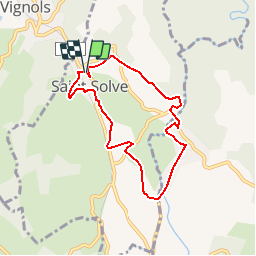
Trail Walking of 6.8 km to be discovered at New Aquitaine, Corrèze, Saint-Solve. This trail is proposed by houbart.
Description
Départ du parking de Saint-Solve
Positioning
Country:
France
Region :
New Aquitaine
Department/Province :
Corrèze
Municipality :
Saint-Solve
Location:
Unknown
Start:(Dec)
Start:(UTM)
374575 ; 5018784 (31T) N.
Comments