


73VA/Tour_Thabor_6j

trietsch
User
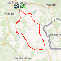

Length
62 km

Max alt
2783 m

Uphill gradient
3498 m
Km-Effort
109 km

Min alt
1585 m

Downhill gradient
3505 m
Boucle
Yes
Creation date :
2017-05-22 00:00:00.0
Updated on :
2020-01-04 20:29:04.464
22h02
Difficulty : Unknown

FREE GPS app for hiking
 SityTrail
IGN / Geographical institutes
SityTrail Plus
The world is yours!
About
Trail Walking of 62 km to be discovered at Auvergne-Rhône-Alpes, Savoy, Valmeinier. This trail is proposed by trietsch.
Description
départ Valmenier
Positioning
Country:
France
Region :
Auvergne-Rhône-Alpes
Department/Province :
Savoy
Municipality :
Valmeinier
Location:
Unknown
Start:(Dec)
Start:(UTM)
302961 ; 5005377 (32T) N.
Comments