


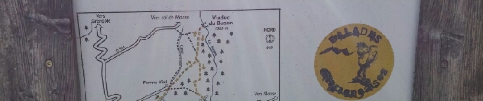
Viaduc du Buzon.(19-03-17)

Dervalmarc
User
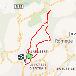

Length
7.3 km

Max alt
1030 m

Uphill gradient
250 m
Km-Effort
10.6 km

Min alt
786 m

Downhill gradient
260 m
Boucle
Yes
Creation date :
2017-05-27 00:00:00.0
Updated on :
2017-05-27 00:00:00.0
1h37
Difficulty : Easy

FREE GPS app for hiking
 SityTrail
IGN / Geographical institutes
SityTrail Plus
The world is yours!
About
Trail Walking of 7.3 km to be discovered at Provence-Alpes-Côte d'Azur, Hautes-Alpes, Gap. This trail is proposed by Dervalmarc.
Description
Vestige d'une ligne de chemin de fer reliant Gap au Champsaur.Cette fut arrêté en raison de la déclaration de la grande guerre.Il en reste de très beaux vestiges dont ce viaduc.
Photos
 - Photo 1")
 - Photo 2")
 - Photo 3")
 - Photo 4")
 - Photo 5")
 - Photo 6")
 - Photo 7")
 - Photo 8")
Positioning
Country:
France
Region :
Provence-Alpes-Côte d'Azur
Department/Province :
Hautes-Alpes
Municipality :
Gap
Location:
Gap
Start:(Dec)
Start:(UTM)
268532 ; 4939573 (32T) N.
Comments