


Cime de L'Arche.Ancelle.05 06 2017

Dervalmarc
User
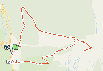

Length
6.5 km

Max alt
2195 m

Uphill gradient
681 m
Km-Effort
15.5 km

Min alt
1524 m

Downhill gradient
676 m
Boucle
Yes
Creation date :
2017-06-05 00:00:00.0
Updated on :
2017-06-05 00:00:00.0
3h05
Difficulty : Difficult

FREE GPS app for hiking
 SityTrail
IGN / Geographical institutes
SityTrail Plus
The world is yours!
About
Trail Walking of 6.5 km to be discovered at Provence-Alpes-Côte d'Azur, Hautes-Alpes, Ancelle. This trail is proposed by Dervalmarc.
Description
Rando trés physique montée courte mais trés soutenue malgré un faible dénivellé.Attention au chutes de pierres dans la montée et descente du col pour accéder a la cime.
Positioning
Country:
France
Region :
Provence-Alpes-Côte d'Azur
Department/Province :
Hautes-Alpes
Municipality :
Ancelle
Location:
Unknown
Start:(Dec)
Start:(UTM)
279331 ; 4942992 (32T) N.
Comments