


Venetië dag 11

karawatsj
User
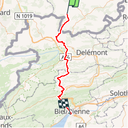

Length
66 km

Max alt
1212 m

Uphill gradient
2450 m
Km-Effort
99 km

Min alt
427 m

Downhill gradient
2447 m
Boucle
No
Creation date :
2017-06-08 00:00:00.0
Updated on :
2017-06-08 00:00:00.0
6h23
Difficulty : Very difficult

FREE GPS app for hiking
 SityTrail
IGN / Geographical institutes
SityTrail Plus
The world is yours!
About
Trail Cycle of 66 km to be discovered at Grand Est, Haut-Rhin, Mooslargue. This trail is proposed by karawatsj.
Description
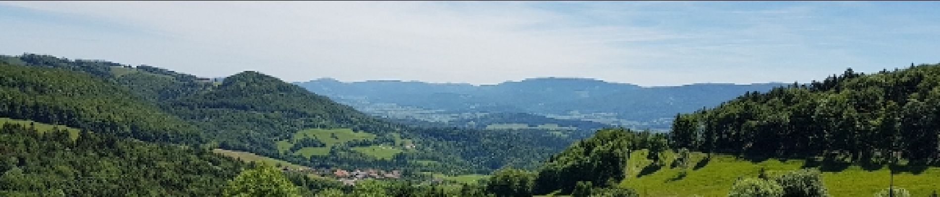
Over de Jura
Photos


Positioning
Country:
France
Region :
Grand Est
Department/Province :
Haut-Rhin
Municipality :
Mooslargue
Location:
Unknown
Start:(Dec)
Start:(UTM)
365927 ; 5263089 (32T) N.
Comments