


2017 Hohnack Katzentahl

staubalex
User

Length
11.4 km

Max alt
965 m

Uphill gradient
159 m
Km-Effort
15.6 km

Min alt
264 m

Downhill gradient
791 m
Boucle
No
Creation date :
2017-06-14 00:00:00.0
Updated on :
2017-06-14 00:00:00.0
54m
Difficulty : Easy

FREE GPS app for hiking
 SityTrail
IGN / Geographical institutes
SityTrail Plus
The world is yours!
About
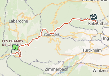
Trail Other activity of 11.4 km to be discovered at Grand Est, Haut-Rhin, Labaroche. This trail is proposed by staubalex.
Positioning
Country:
France
Region :
Grand Est
Department/Province :
Haut-Rhin
Municipality :
Labaroche
Location:
Unknown
Start:(Dec)
Start:(UTM)
364913 ; 5327316 (32U) N.
Comments