![](/images/other/stat-length.png)
![Trail Walking Theys - Le Grand Rocher en boucle - Photo](https://media.geolcdn.com/t/1900/400/ext.pjpeg?maxdim=2&url=https%3A%2F%2Fservices.sitytrail.com%2FGeolivesWS%2FDownloadMedia.ashx%3FTrailID%3D773550%26Media%3Dfix__20170615121238.jpg)
Le Grand Rocher en boucle
patjobou
User
![Length](/images/other/stat-length.png)
Length
12 km
![Max alt](https://static1.geolcdn.com/siteimages/upload/files/1508320355ic_sort_altitude_max_24dp.png)
Max alt
1915 m
![Uphill gradient](https://static1.geolcdn.com/siteimages/upload/files/1508320355ic_sort_den_pos_24dp.png)
Uphill gradient
577 m
![Km-Effort](/images/other/stat-length.png)
Km-Effort
19.8 km
![Min alt](https://static1.geolcdn.com/siteimages/upload/files/1508320355ic_sort_altitude_min_24dp.png)
Min alt
1346 m
![Downhill gradient](https://static1.geolcdn.com/siteimages/upload/files/1508320355ic_sort_den_neg_24dp.png)
Downhill gradient
581 m
![Boucle](https://static1.geolcdn.com/siteimages/upload/files/16400158638029165_repeat_loop_refresh_sync_direction_icon.png)
Boucle
Yes
Creation date :
2017-06-16 00:00:00.0
Updated on :
2017-06-16 00:00:00.0
![Walking](https://static1.geolcdn.com/sitytour/trail-icons/101.png)
4h08
Difficulty : Medium
![Scan this QR Code to open this trail in the SityTrail application](https://capi.geolives.com/qq0zvz2zws4bq2lad0pu/sitytour/trails/773550/qr.png?size=200)
FREE GPS app for hiking
About
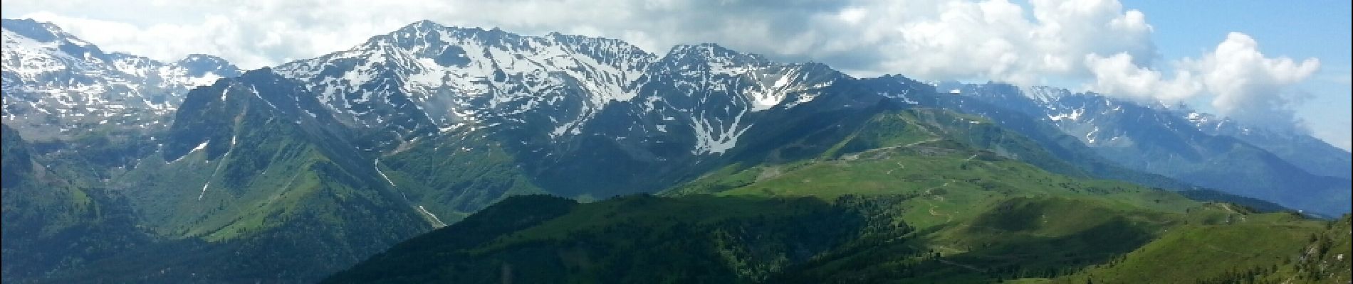
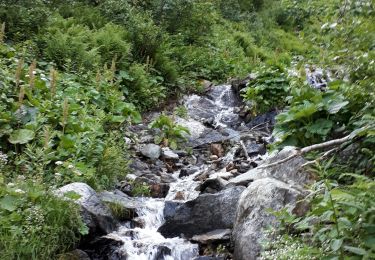
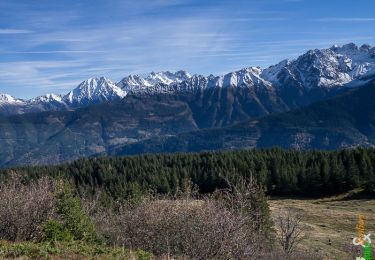
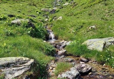
Trail Walking of 12 km to be discovered at Auvergne-Rhône-Alpes, Isère, Theys. This trail is proposed by patjobou.
Description
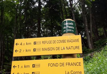
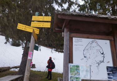
Départ au bout de la route goudronnée: au Carrefour des quatre chemins.Montée agréable, au frais jusqu'au col de Merdaret; retour par le Cret Luisard; Ça passe sur un sentier peu marqué au début, entre le chalet de Pierre Roubet et le point 1394.
Positioning
Country:
France
Region :
Auvergne-Rhône-Alpes
Department/Province :
Isère
Municipality :
Theys
Location:
Unknown
Start:(Dec)
Start:(UTM)
267169 ; 5021341 (32T) N.
Comments
Trails nearby
![Trail Walking Le Haut-Bréda - Lac Blanc Lac de la Folle - Photo](https://media.geolcdn.com/t/375/260/ext.jpg?maxdim=2&url=https%3A%2F%2Fmedia.geolcdn.com%2Ff%2Ff4e38b80-48fc-49d4-b675-d255436e858e.jpg)
![Walking Walking](https://static1.geolcdn.com/sitytour/trail-icons/101.png)
Lac Blanc Lac de la Folle
Walking
Very difficult
(1)
Le Haut-Bréda,
Auvergne-Rhône-Alpes,
Isère,
France
![](/images/other/stat-length.png)
12.2 km | 28 km-effort
6h 59min
![](https://static1.geolcdn.com/siteimages/upload/files/16400158638029165_repeat_loop_refresh_sync_direction_icon.png)
Yes
![Trail Walking Crêts-en-Belledonne - Le Grand Rocher 1926m, depuis le Foyer du Barioz - Photo](https://media.geolcdn.com/t/375/260/ext.jpg?maxdim=2&url=https%3A%2F%2Fservices.sitytrail.com%2FGeolivesWS%2FDownloadMedia.ashx%3FTrailID%3D317211%26Media%3D16386_1.jpg)
![Walking Walking](https://static1.geolcdn.com/sitytour/trail-icons/101.png)
Le Grand Rocher 1926m, depuis le Foyer du Barioz
Walking
Medium
(3)
Crêts-en-Belledonne,
Auvergne-Rhône-Alpes,
Isère,
France
![](/images/other/stat-length.png)
9.7 km | 16.6 km-effort
5h 30min
![](https://static1.geolcdn.com/siteimages/upload/files/16400158638029165_repeat_loop_refresh_sync_direction_icon.png)
Yes
![Trail Walking Le Haut-Bréda - Combe du Prat - Photo](https://media.geolcdn.com/t/375/260/ext.jpg?maxdim=2&url=https%3A%2F%2Fmedia.geolcdn.com%2Ff%2F6714bc1b-1337-4dda-8a6e-4ad571484b33.jpg)
![Walking Walking](https://static1.geolcdn.com/sitytour/trail-icons/101.png)
Combe du Prat
Walking
Medium
Le Haut-Bréda,
Auvergne-Rhône-Alpes,
Isère,
France
![](/images/other/stat-length.png)
9.5 km | 16.7 km-effort
3h 18min
![](https://static1.geolcdn.com/siteimages/upload/files/16400158638029165_repeat_loop_refresh_sync_direction_icon.png)
Yes
![Trail Mountain bike Theys - Autour du crêt de Chazay - Photo](https://media.geolcdn.com/t/375/260/ext.jpg?maxdim=2&url=https%3A%2F%2Fstatic1.geolcdn.com%2Fsiteimages%2Fupload%2Ffiles%2F1524743154velo.jpg)
![Mountain bike Mountain bike](https://static1.geolcdn.com/sitytour/trail-icons/202.png)
Autour du crêt de Chazay
Mountain bike
Medium
(1)
Theys,
Auvergne-Rhône-Alpes,
Isère,
France
![](/images/other/stat-length.png)
15.7 km | 23 km-effort
2h 30min
![](https://static1.geolcdn.com/siteimages/upload/files/16400158638029165_repeat_loop_refresh_sync_direction_icon.png)
Yes
![Trail Walking Le Haut-Bréda - Les lacs sept Claux - Photo](https://media.geolcdn.com/t/375/260/ext.jpg?maxdim=2&url=https%3A%2F%2Fmedia.geolcdn.com%2Ff%2Fab2c771e-7afd-4d71-bf80-bad543cd1a27.jpg)
![Walking Walking](https://static1.geolcdn.com/sitytour/trail-icons/101.png)
Les lacs sept Claux
Walking
Difficult
Le Haut-Bréda,
Auvergne-Rhône-Alpes,
Isère,
France
![](/images/other/stat-length.png)
12.8 km | 27 km-effort
6h 56min
![](https://static1.geolcdn.com/siteimages/upload/files/16400158638029165_repeat_loop_refresh_sync_direction_icon.png)
Yes
![Trail Walking Le Haut-Bréda - cascade du Pissou - Photo](https://media.geolcdn.com/t/375/260/ext.jpg?maxdim=2&url=https%3A%2F%2Fmedia.geolcdn.com%2Ff%2F7fdcfb11-ea55-4bb4-a796-d901baffbbd4.jpg)
![Walking Walking](https://static1.geolcdn.com/sitytour/trail-icons/101.png)
cascade du Pissou
Walking
Medium
Le Haut-Bréda,
Auvergne-Rhône-Alpes,
Isère,
France
![](/images/other/stat-length.png)
5.9 km | 8.9 km-effort
2h 3min
![](https://static1.geolcdn.com/siteimages/upload/files/16400158638029165_repeat_loop_refresh_sync_direction_icon.png)
Yes
![Trail Other activity Le Haut-Bréda - Rocher Blanc 7 Laux - Photo](https://media.geolcdn.com/t/375/260/ext.jpg?maxdim=2&url=https%3A%2F%2Fstatic1.geolcdn.com%2Fsiteimages%2Fupload%2Ffiles%2F1545311037marcheuse_200dpi.jpg)
![Other activity Other activity](https://static1.geolcdn.com/sitytour/trail-icons/900.png)
Rocher Blanc 7 Laux
Other activity
Very difficult
(1)
Le Haut-Bréda,
Auvergne-Rhône-Alpes,
Isère,
France
![](/images/other/stat-length.png)
18.9 km | 44 km-effort
11h 2min
![](https://static1.geolcdn.com/siteimages/upload/files/16400158638029165_repeat_loop_refresh_sync_direction_icon.png)
Yes
![Trail Winter sports Crêts-en-Belledonne - Le grand Rocher - Photo](https://media.geolcdn.com/t/375/260/ext.jpg?maxdim=2&url=https%3A%2F%2Fstatic1.geolcdn.com%2Fsiteimages%2Fupload%2Ffiles%2F1524743153ski.jpg)
![Winter sports Winter sports](https://static1.geolcdn.com/sitytour/trail-icons/500.png)
Le grand Rocher
Winter sports
Easy
(1)
Crêts-en-Belledonne,
Auvergne-Rhône-Alpes,
Isère,
France
![](/images/other/stat-length.png)
6.4 km | 12.8 km-effort
3h 0min
![](https://static1.geolcdn.com/siteimages/upload/files/16400158638029165_repeat_loop_refresh_sync_direction_icon.png)
Yes
![Trail Walking Theys - le grand rocher - Photo](https://media.geolcdn.com/t/375/260/ext.jpg?maxdim=2&url=https%3A%2F%2Fmedia.geolcdn.com%2Ff%2F814bc816-9849-4837-9e69-e500a15e5b46.jpg)
![Walking Walking](https://static1.geolcdn.com/sitytour/trail-icons/101.png)
le grand rocher
Walking
Medium
Theys,
Auvergne-Rhône-Alpes,
Isère,
France
![](/images/other/stat-length.png)
9.4 km | 15.5 km-effort
2h 35min
![](https://static1.geolcdn.com/siteimages/upload/files/16400158638029165_repeat_loop_refresh_sync_direction_icon.png)
No