


camporeil

bdbedeille
User
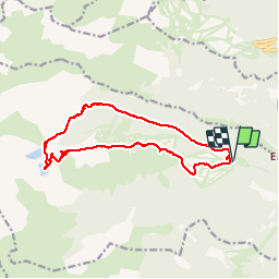

Length
15 km

Max alt
2418 m

Uphill gradient
775 m
Km-Effort
25 km

Min alt
1750 m

Downhill gradient
774 m
Boucle
Yes
Creation date :
2017-06-22 00:00:00.0
Updated on :
2017-06-22 00:00:00.0
7h06
Difficulty : Difficult

FREE GPS app for hiking
 SityTrail
IGN / Geographical institutes
SityTrail Plus
The world is yours!
About
Trail Walking of 15 km to be discovered at Occitania, Pyrénées-Orientales, Formiguères. This trail is proposed by bdbedeille.


Positioning
Country:
France
Region :
Occitania
Department/Province :
Pyrénées-Orientales
Municipality :
Formiguères
Location:
Unknown
Start:(Dec)
Start:(UTM)
423722 ; 4719414 (31T) N.
Comments