


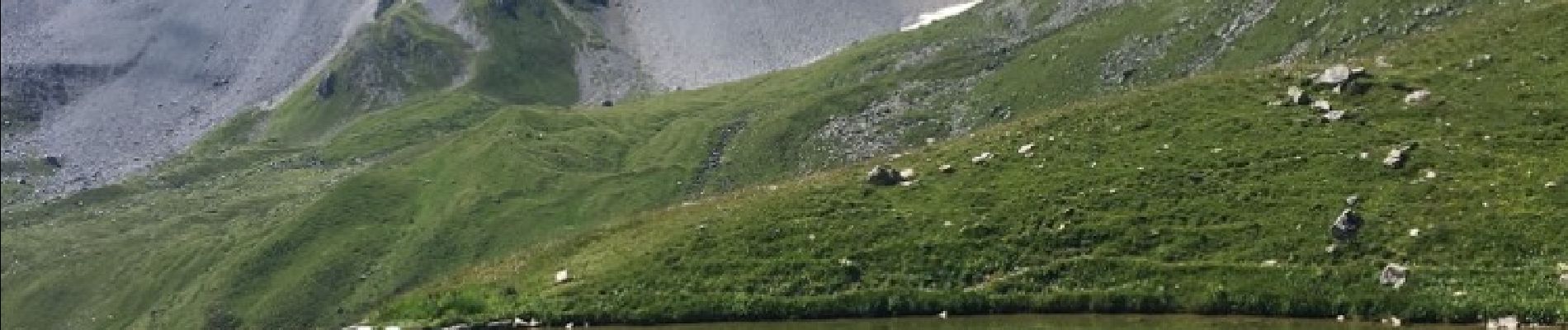
lac des creux au départ de l'altiport

Klhn
User
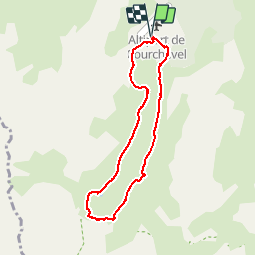

Length
6.8 km

Max alt
2299 m

Uphill gradient
323 m
Km-Effort
11.1 km

Min alt
1987 m

Downhill gradient
326 m
Boucle
Yes
Creation date :
2017-07-20 00:00:00.0
Updated on :
2017-07-20 00:00:00.0
2h40
Difficulty : Easy

FREE GPS app for hiking
 SityTrail
IGN / Geographical institutes
SityTrail Plus
The world is yours!
About
Trail Walking of 6.8 km to be discovered at Auvergne-Rhône-Alpes, Savoy, Courchevel. This trail is proposed by Klhn.
Description
Piste mal délimitée sur la fin
Photos

Positioning
Country:
France
Region :
Auvergne-Rhône-Alpes
Department/Province :
Savoy
Municipality :
Courchevel
Location:
Saint-Bon-Tarentaise
Start:(Dec)
Start:(UTM)
314838 ; 5029630 (32T) N.
Comments
Magnifique parcours avec de temps en temps des petits visiteurs