


Le Croisse Baulet

cron
User
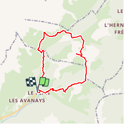

Length
14 km

Max alt
2224 m

Uphill gradient
1068 m
Km-Effort
28 km

Min alt
1224 m

Downhill gradient
1070 m
Boucle
Yes
Creation date :
2017-07-31 00:00:00.0
Updated on :
2017-07-31 00:00:00.0
5h45
Difficulty : Difficult

FREE GPS app for hiking
 SityTrail
IGN / Geographical institutes
SityTrail Plus
The world is yours!
About
Trail Walking of 14 km to be discovered at Auvergne-Rhône-Alpes, Savoy, La Giettaz. This trail is proposed by cron.
Positioning
Country:
France
Region :
Auvergne-Rhône-Alpes
Department/Province :
Savoy
Municipality :
La Giettaz
Location:
Unknown
Start:(Dec)
Start:(UTM)
307903 ; 5083649 (32T) N.
Comments