


Dent du colerin Rando ski

Michel_Martin
User

Length
5.3 km

Max alt
3286 m

Uphill gradient
1253 m
Km-Effort
17.9 km

Min alt
2028 m

Downhill gradient
0 m
Boucle
No
Creation date :
2019-04-16 15:17:19.86
Updated on :
2019-04-16 15:17:19.945
2h18
Difficulty : Easy

FREE GPS app for hiking
 SityTrail
IGN / Geographical institutes
SityTrail Plus
The world is yours!
About
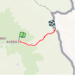
Trail Walking of 5.3 km to be discovered at Auvergne-Rhône-Alpes, Savoy, Bessans. This trail is proposed by Michel_Martin.
Description
rando ski 17/04/17
Positioning
Country:
France
Region :
Auvergne-Rhône-Alpes
Department/Province :
Savoy
Municipality :
Bessans
Location:
Unknown
Start:(Dec)
Start:(UTM)
348713 ; 5018549 (32T) N.
Comments