Trail Walking Mauzac - Mauzac (la Grange) - Photo

Mauzac (la Grange)

 pidjam
pidjam

User

© OpenStreetMap contributors
Length
Length
11.1 km
Max alt
Max alt
286 m
Uphill gradient
Uphill gradient
219 m
Km-Effort
Km-Effort  
14.1 km
Min alt
Min alt
179 m
Downhill gradient
Downhill gradient
219 m
Boucle
Boucle
Yes
Creation date :
2017-08-14 00:00:00.0
Updated on :
2017-08-14 00:00:00.0

(0 Reviews)

Walking
Walking
3h07
Difficulty : Easy

Scan this QR Code to open this trail in the SityTrail application

FREE GPS app for hiking

Logo SityTrail SityTrail

IGN / Geographical institutes

Download SityTrail from the App Store Download SityTrail from Google Play

Logo SityTrail SityTrail World

The world is yours!

Download SityTrail from the App Store Download SityTrail from Google Play Download SityTrail on Huawei AppGallery

About

Trail Walking of 11.1 km to be discovered at Occitania, Haute-Garonne, Mauzac. This trail is proposed by pidjam.

Description

circuit autour de Mauzac (reconnu en aout 2017).
Attention à la descente finale (très pentue et potentiellement glissante bien que ce soit un GR)
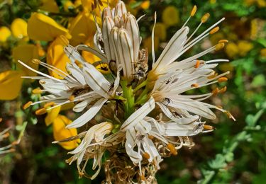
Elevation profile

Photos

Positioning

Country:
France
Region :
Occitania
Department/Province :
Haute-Garonne
Municipality :
Mauzac
Location:
Unknown
Start:(UTM)
361573 ; 4803984 (31T) N.

Trails nearby

Trail Walking Muret - Estantens st amans - Photo
Walking
pidjam

Walking

Easy
Muret, Occitania, Haute-Garonne, France
10.3 km | 13.2 km-effort
2h 8min
Yes
Trail Walking Eaunes - EAUNES-CHAPELLE ST AMANS en boucle - Photo
Walking
chrisgps

Walking

Easy
Eaunes, Occitania, Haute-Garonne, France
10.9 km | 14.3 km-effort
2h 49min
Yes
Trail Walking Eaunes - EAUNES-CHAPELLE ST AMANS en boucle - Photo
Walking
chrisgps

Walking

Medium
Eaunes, Occitania, Haute-Garonne, France
11 km | 14.5 km-effort
2h 34min
Yes
Trail Mountain bike Longages - viagarona2 - Photo
Mountain bike
ra2000

Mountain bike

Medium
Longages, Occitania, Haute-Garonne, France
50 km | 59 km-effort
7h 40min
No
Trail Walking Mauzac - Mauzac-St Genies - Photo
Walking
pidjam

Walking

Easy
Mauzac, Occitania, Haute-Garonne, France
10.8 km | 14.3 km-effort
3h 20min
Yes
Trail Walking Muret - De l'Aouach à St Amans - Muret - Photo
Walking
tracegps

Walking

Medium
Muret, Occitania, Haute-Garonne, France
9.1 km | 12.6 km-effort
2h 30min
Yes
Trail Walking Le Fauga - Boucle L'Aouach Estantens - Photo
Walking
tracegps

Walking

Medium
Le Fauga, Occitania, Haute-Garonne, France
11.5 km | 15.9 km-effort
3h 30min
Yes
Trail Walking Lavernose-Lacasse - De Lavernose à Noé et retour - Photo
Walking
tracegps

Walking

Medium
Lavernose-Lacasse, Occitania, Haute-Garonne, France
18.6 km | 20 km-effort
5h 0min
No
Trail Walking Lavernose-Lacasse - Boucle de Lavernose  - Photo
Walking
tracegps

Walking

Easy
Lavernose-Lacasse, Occitania, Haute-Garonne, France
10.2 km | 10.9 km-effort
3h 0min
Yes


Close
My subscriptions