Trail Walking Saint-Pierre-lès-Nemours - pso-170814 - NemoursGréau-Sarrasin - Photo

pso-170814 - NemoursGréau-Sarrasin

 randodan
randodan

User

© OpenStreetMap contributors
Length
Length
12.1 km
Max alt
Max alt
116 m
Uphill gradient
Uphill gradient
237 m
Km-Effort
Km-Effort  
15.3 km
Min alt
Min alt
73 m
Downhill gradient
Downhill gradient
235 m
Boucle
Boucle
Yes
Creation date :
2017-08-28 00:00:00.0
Updated on :
2017-08-28 00:00:00.0

(0 Reviews)

Walking
Walking
5h00
Difficulty : Easy

Scan this QR Code to open this trail in the SityTrail application

FREE GPS app for hiking

Logo SityTrail SityTrail

IGN / Geographical institutes

Download SityTrail from the App Store Download SityTrail from Google Play

Logo SityTrail SityTrail World

The world is yours!

Download SityTrail from the App Store Download SityTrail from Google Play Download SityTrail on Huawei AppGallery

About

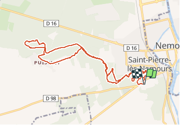
Trail Walking of 12.1 km to be discovered at Ile-de-France, Seine-et-Marne, Saint-Pierre-lès-Nemours. This trail is proposed by randodan.

Description

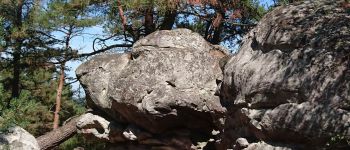
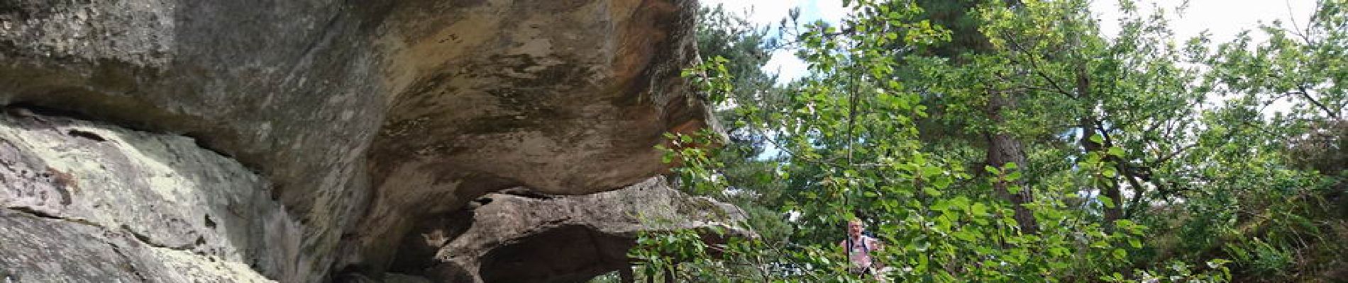
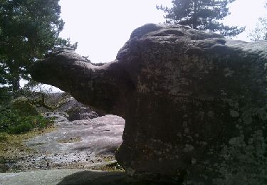
Des Rochers Gréau au Mont Sarrasin.<br>
- Lundi 14 août 2017 -<br>
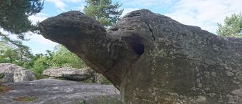
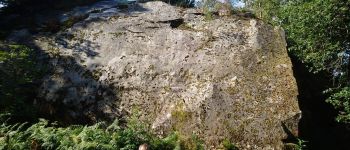
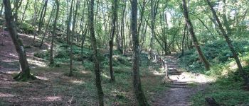
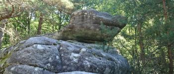
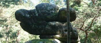
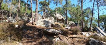
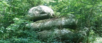
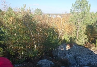
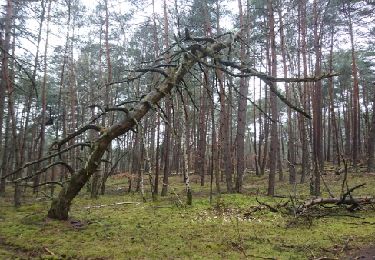
9h, départ du parking près de la piscine Aquasud de Nemours . La Tortue est notre 1er objectif dans les Rochers Gréau . Après les beaux rochers et la 2e bosse, on prend le GR 13 vers le Puiselet . Petite erreur de parcours et nous rectifions par un chouette hors piste . Après le Puiselet, nous attaquons le Mont Sarrasin et son chaos rocheux . Là aussi, de beaux rochers.<br>
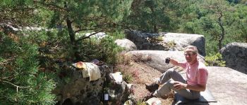
12h10 sur la 2e bosse, nous nous installons pour le pique-nique . Soleil plombant, même JP recherche l'ombre ;o).<br>
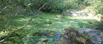
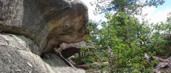
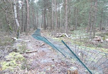
13h10, redescendons du Mont Sarrasin et direction retour . Intéressé par un "réservoir", je tente son approche en hors piste, mais nous le ratons . Retour par la Tortue et essayons d'en descendre en hors piste, mais ça finit en vrai sentier de lapins.<br>
15h, sommes de retour au parking.<br>
Au départ de la maison, il faisait 9°, de retour à la voiture, il faisait 27° !<br>
JP,Da.<br>
<small><i>Merci à philippepauleau pour ce superbe circuit.</i></small>

Elevation profile

Photos

Points of interest

Point of interest Saint-Pierre-lès-Nemours - 01 - La Tortue - Photo
randodan
SAINT-PIERRE-LÈS-NEMOURS 
Point of interest Saint-Pierre-lès-Nemours - 02 - Un très gros caillou - Photo
randodan
SAINT-PIERRE-LÈS-NEMOURS 
Point of interest Saint-Pierre-lès-Nemours - 03 - Une belle petite mare toute verte de lentilles - Photo
randodan
SAINT-PIERRE-LÈS-NEMOURS 
Point of interest Saint-Pierre-lès-Nemours - 04 - Trop bien aménagé ce sous-bois, y a même des escaliers - Photo
randodan
SAINT-PIERRE-LÈS-NEMOURS 
Point of interest Saint-Pierre-lès-Nemours - 05 - Faut deviner (imaginer) à quoi ressemble ce rocher - Photo
randodan
SAINT-PIERRE-LÈS-NEMOURS 
Point of interest Saint-Pierre-lès-Nemours - 06 - Mickey Mouse ! - Photo
randodan
SAINT-PIERRE-LÈS-NEMOURS 
Point of interest Saint-Pierre-lès-Nemours - 07 - Le premier chaos du Mont Sarrasin - Photo
randodan
SAINT-PIERRE-LÈS-NEMOURS 
Point of interest Saint-Pierre-lès-Nemours - 08 - Un gros toutou - Photo
randodan
SAINT-PIERRE-LÈS-NEMOURS 
Point of interest Saint-Pierre-lès-Nemours - 09 - Pique-Nique sur le Mont Sarrasin (bosse ouest) - Photo
randodan
SAINT-PIERRE-LÈS-NEMOURS 
Point of interest Saint-Pierre-lès-Nemours - 10 - Laissez parler votre imagination... - Photo
randodan
SAINT-PIERRE-LÈS-NEMOURS 
Point of interest Saint-Pierre-lès-Nemours - 11 - Curiosité : un double auvent - Photo
randodan
SAINT-PIERRE-LÈS-NEMOURS 

Positioning

Country:
France
Region :
Ile-de-France
Department/Province :
Seine-et-Marne
Municipality :
Saint-Pierre-lès-Nemours
Location:
Unknown
Start:(UTM)
476639 ; 5345126 (31U) N.

Trails nearby

Trail Walking Saint-Pierre-lès-Nemours - Rochers Gréau et Puiselet - Photo
Walking
Philippepauleau

Walking

Medium
(1)
Saint-Pierre-lès-Nemours, Ile-de-France, Seine-et-Marne, France
10.8 km | 13.2 km-effort
2h 41min
Yes
Trail Walking Poligny - polynoise 2017 - Photo
Walking
joelinou

Walking

Medium
(2)
Poligny, Ile-de-France, Seine-et-Marne, France
19.3 km | 23 km-effort
3h 44min
Yes
Trail Mountain bike Poligny - Poligny 55km - Photo
Mountain bike
besn0847

Mountain bike

Difficult
(1)
Poligny, Ile-de-France, Seine-et-Marne, France
55 km | 64 km-effort
4h 9min
No
Trail On foot Saint-Pierre-lès-Nemours - Le Mont Blanc de la Commanderie - Photo
On foot
chessyca

On foot

Medium
Saint-Pierre-lès-Nemours, Ile-de-France, Seine-et-Marne, France
26 km | 30 km-effort
6h 50min
No
Trail Walking Saint-Pierre-lès-Nemours - De Nemours à Moret + halte resto Bourron Marlotte - Photo
Walking
chessyca

Walking

Very easy
Saint-Pierre-lès-Nemours, Ile-de-France, Seine-et-Marne, France
33 km | 36 km-effort
6h 14min
No
Trail Other activity Nemours - 181109 SVG - Photo
Other activity
MarcheEtReve

Other activity

Very easy
Nemours, Ile-de-France, Seine-et-Marne, France
12.7 km | 14.7 km-effort
5h 22min
Yes
Trail Other activity Nemours - 181109 EnCours - Photo
Other activity
MarcheEtReve

Other activity

Very easy
Nemours, Ile-de-France, Seine-et-Marne, France
12.7 km | 14.7 km-effort
5h 22min
Yes
Trail Walking Nemours - 180327 EnCours - Photo
Walking
MarcheEtReve

Walking

Very easy
Nemours, Ile-de-France, Seine-et-Marne, France
9.1 km | 10.3 km-effort
2h 55min
Yes
Trail Walking Nemours - SVG 180205-pso - RECO partielle Polinoise - Photo
Walking
MarcheEtReve

Walking

Very easy
Nemours, Ile-de-France, Seine-et-Marne, France
7.6 km | 8.9 km-effort
3h 0min
Yes


Close
My subscriptions