


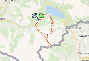
MontCenis-tour lac- 3 jours

m261212
User

Length
23 km

Max alt
2698 m

Uphill gradient
979 m
Km-Effort
36 km

Min alt
2011 m

Downhill gradient
980 m
Boucle
Yes
Creation date :
2017-08-21 00:00:00.0
Updated on :
2017-08-21 00:00:00.0
7h23
Difficulty : Medium

FREE GPS app for hiking
 SityTrail
IGN / Geographical institutes
SityTrail Plus
The world is yours!
About
Trail Walking of 23 km to be discovered at Auvergne-Rhône-Alpes, Savoy, Val-Cenis. This trail is proposed by m261212.
Positioning
Country:
France
Region :
Auvergne-Rhône-Alpes
Department/Province :
Savoy
Municipality :
Val-Cenis
Location:
Bramans
Start:(Dec)
Start:(UTM)
333937 ; 5009403 (32T) N.
Comments