


Val d ayas Monte Zerbion

chris13370
User
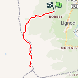

Length
8.2 km

Max alt
2695 m

Uphill gradient
801 m
Km-Effort
18.9 km

Min alt
1897 m

Downhill gradient
800 m
Boucle
Yes
Creation date :
2018-04-16 23:06:29.033
Updated on :
2018-04-16 23:06:29.033
5h07
Difficulty : Unknown

FREE GPS app for hiking
 SityTrail
IGN / Geographical institutes
SityTrail Plus
The world is yours!
About
Trail Walking of 8.2 km to be discovered at Aosta Valley, Unknown, Ayas. This trail is proposed by chris13370.
Description
vue superbe sur tous les sommets
Positioning
Country:
Italy
Region :
Aosta Valley
Department/Province :
Unknown
Municipality :
Ayas
Location:
Unknown
Start:(Dec)
Start:(UTM)
397206 ; 5073757 (32T) N.
Comments