


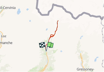
Val d ayas refuge de Mezzalama 3009 m par Lago bleu

chris13370
User

Length
16.4 km

Max alt
2989 m

Uphill gradient
1299 m
Km-Effort
34 km

Min alt
1688 m

Downhill gradient
1299 m
Boucle
Yes
Creation date :
2017-09-18 00:00:00.0
Updated on :
2017-09-18 00:00:00.0
7h49
Difficulty : Unknown

FREE GPS app for hiking
 SityTrail
IGN / Geographical institutes
SityTrail Plus
The world is yours!
About
Trail Walking of 16.4 km to be discovered at Aosta Valley, Unknown, Ayas. This trail is proposed by chris13370.
Description
départ st Jacques 100m montée
Positioning
Country:
Italy
Region :
Aosta Valley
Department/Province :
Unknown
Municipality :
Ayas
Location:
Unknown
Start:(Dec)
Start:(UTM)
401473 ; 5079567 (32T) N.
Comments