


73Va/Refuge_T.Rouges/Thabor sommet

trietsch
User
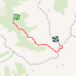

Length
6.9 km

Max alt
3168 m

Uphill gradient
1037 m
Km-Effort
17.3 km

Min alt
2130 m

Downhill gradient
5 m
Boucle
No
Creation date :
2018-04-16 23:27:57.877
Updated on :
2020-01-04 20:28:57.471
3h57
Difficulty : Difficult

FREE GPS app for hiking
 SityTrail
IGN / Geographical institutes
SityTrail Plus
The world is yours!
About
Trail Walking of 6.9 km to be discovered at Auvergne-Rhône-Alpes, Savoy, Valmeinier. This trail is proposed by trietsch.
Positioning
Country:
France
Region :
Auvergne-Rhône-Alpes
Department/Province :
Savoy
Municipality :
Valmeinier
Location:
Unknown
Start:(Dec)
Start:(UTM)
304162 ; 5000671 (32T) N.
Comments