Trail Walking Châteauroux-les-Alpes - Rome-42-St Alban-Eygliers-20170913 - Photo
© OpenStreetMap contributors
Length
Length
17.9 km
Max alt
Max alt
1281 m
Uphill gradient
Uphill gradient
605 m
Km-Effort
Km-Effort  
26 km
Min alt
Min alt
881 m
Downhill gradient
Downhill gradient
676 m
Boucle
Boucle
No
Creation date :
2018-04-16 23:41:13.599
Updated on :
2022-11-23 08:10:24.122

(0 Reviews)

Walking
Walking
5h12
Difficulty : Difficult

Scan this QR Code to open this trail in the SityTrail application

FREE GPS app for hiking

Logo SityTrail SityTrail

IGN / Geographical institutes

Download SityTrail from the App Store Download SityTrail from Google Play

Logo SityTrail SityTrail World

The world is yours!

Download SityTrail from the App Store Download SityTrail from Google Play Download SityTrail on Huawei AppGallery

About

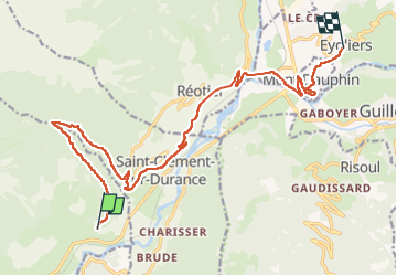
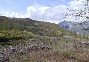
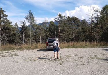
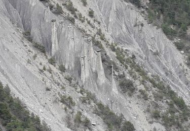
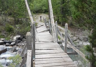
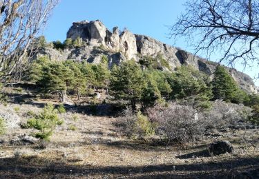
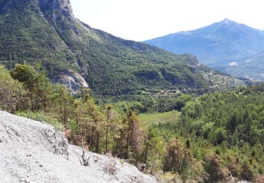
Trail Walking of 17.9 km to be discovered at Provence-Alpes-Côte d'Azur, Hautes-Alpes, Châteauroux-les-Alpes. This trail is proposed by patrickdanilo.

Description

ALTA-22-N°0408F42-GR653D

Elevation profile

Photos

Positioning

Country:
France
Region :
Provence-Alpes-Côte d'Azur
Department/Province :
Hautes-Alpes
Municipality :
Châteauroux-les-Alpes
Location:
Unknown
Start:(UTM)
306217 ; 4945368 (32T) N.

Trails nearby

Trail Walking Saint-André-d'Embrun - mont Aurel - Photo
Walking
gibello

Walking

Medium
(1)
Saint-André-d'Embrun, Provence-Alpes-Côte d'Azur, Hautes-Alpes, France
8.2 km | 18.4 km-effort
4h 30min
Yes
Trail Walking Châteauroux-les-Alpes - boucle cascade de la pisse - Photo
Walking
gildascb

Walking

Very easy
(1)
Châteauroux-les-Alpes, Provence-Alpes-Côte d'Azur, Hautes-Alpes, France
8.8 km | 12.4 km-effort
2h 17min
Yes
Trail Walking Saint-André-d'Embrun - Boucle lac de Siguret et Chapelle Saint Roch - Photo
Walking
gildascb

Walking

Medium
Saint-André-d'Embrun, Provence-Alpes-Côte d'Azur, Hautes-Alpes, France
6.7 km | 9.6 km-effort
2h 14min
Yes
Trail Walking Risoul - plan de phazy par la forêt de risoul en boucle - Photo
Walking
tchoua

Walking

Difficult
Risoul, Provence-Alpes-Côte d'Azur, Hautes-Alpes, France
17.5 km | 34 km-effort
4h 38min
Yes
Trail Walking Châteauroux-les-Alpes - la cascade de la Pisse  - Photo
Walking
GILOU440

Walking

Medium
Châteauroux-les-Alpes, Provence-Alpes-Côte d'Azur, Hautes-Alpes, France
11.1 km | 15.9 km-effort
4h 26min
Yes
Trail Walking Châteauroux-les-Alpes - Cascade de la Pise Chateauroux - Photo
Walking
Sorriaux

Walking

Easy
Châteauroux-les-Alpes, Provence-Alpes-Côte d'Azur, Hautes-Alpes, France
11 km | 15.7 km-effort
3h 31min
Yes
Trail Walking Saint-Clément-sur-Durance - Pic de Rochelaire - Photo
Walking
GUIDE
David25400

Walking

Very difficult
Saint-Clément-sur-Durance, Provence-Alpes-Côte d'Azur, Hautes-Alpes, France
16 km | 37 km-effort
7h 21min
Yes
Trail Walking Eygliers - MONT DAUPHIN  tour et main du Titan  - Photo
Walking
SyMA

Walking

Easy
Eygliers, Provence-Alpes-Côte d'Azur, Hautes-Alpes, France
8.1 km | 11.6 km-effort
2h 5min
Yes
Trail Walking Châteauroux-les-Alpes - Cascade de la pisse (un grand classique) - Photo
Walking
gildascb

Walking

Very easy
Châteauroux-les-Alpes, Provence-Alpes-Côte d'Azur, Hautes-Alpes, France
10.9 km | 16.2 km-effort
3h 31min
Yes


Close
My subscriptions