Trail Walking Marsanne - marsanne La fontaine miraculeuse - Photo

marsanne La fontaine miraculeuse

 bob2023
bob2023

User

© OpenStreetMap contributors
Length
Length
8.3 km
Max alt
Max alt
596 m
Uphill gradient
Uphill gradient
320 m
Km-Effort
Km-Effort  
12.5 km
Min alt
Min alt
307 m
Downhill gradient
Downhill gradient
319 m
Boucle
Boucle
Yes
Creation date :
2018-08-26 08:31:51.655
Updated on :
2018-08-26 08:31:51.685

(0 Reviews)

Walking
Walking
2h43
Difficulty : Unknown

Scan this QR Code to open this trail in the SityTrail application

FREE GPS app for hiking

Logo SityTrail SityTrail

IGN / Geographical institutes

Download SityTrail from the App Store Download SityTrail from Google Play

Logo SityTrail SityTrail World

The world is yours!

Download SityTrail from the App Store Download SityTrail from Google Play Download SityTrail on Huawei AppGallery

About

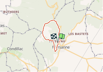
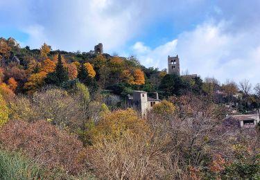
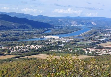
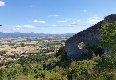
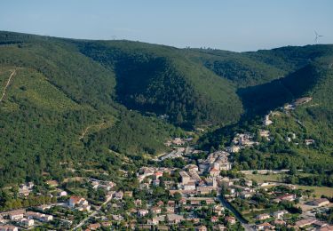
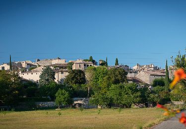
Trail Walking of 8.3 km to be discovered at Auvergne-Rhône-Alpes, Drôme, Marsanne. This trail is proposed by bob2023.

Description

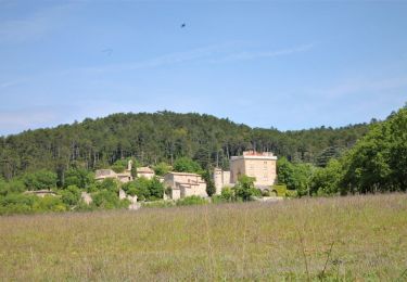
La randonnée débute au parking de Notre Dame de Fresneau, N'hésitez surtout pas à remplir vos bouteilles à la fontaine miraculeuse Elle vous donnera des forces pour la montée du début de cette randonnée.
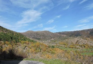
La première partie de cette randonnée consiste en une montée d'environ 40 minutes qui mène au col de la grande-limite.
La deuxième partie suit une route forestière, non conseillé par forte chaleur.
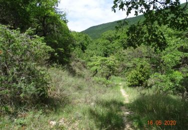
La troisième et dernière partie passe dans une forêt de buis qui malheureusement a été dévastée par la pyrale.
Attention au niveau de la direction de serre de paruel, Le chemin est à environ une cinquantaine de mètres avant le tracé se trouvant sur la carte IGN. Il y a de toute façon un panneau indiquant la bonne direction .

Elevation profile

Points of interest

Point of interest Marsanne - Creux des alexis - Photo
bob2023
Point of interest Marsanne - chemin du  millieu - Photo
bob2023
Point of interest Marsanne - ligne haute tension - Photo
bob2023
Point of interest Marsanne - Tourner à droite - Photo
bob2023
Point of interest Marsanne - Tourner à gauche - Photo
bob2023
Point of interest Marsanne - Continuer à droite - Photo
bob2023

Positioning

Country:
France
Region :
Auvergne-Rhône-Alpes
Department/Province :
Drôme
Municipality :
Marsanne
Location:
Unknown
Start:(UTM)
648240 ; 4945463 (31T) N.

Comments

Please log in to post a review or rate the element


Trails nearby

Trail Motor Saulce-sur-Rhône - sortie 4x4 - Photo
Motor
rodo6269

Motor

Difficult
(1)
Saulce-sur-Rhône, Auvergne-Rhône-Alpes, Drôme, France
94 km | 136 km-effort
10h 48min
No
Trail Walking Marsanne - Marsanne Les Fileuses 11km - Photo
Walking
chancha

Walking

Difficult
Marsanne, Auvergne-Rhône-Alpes, Drôme, France
10 km | 14.5 km-effort
3h 17min
Yes
Trail Walking La Coucourde - La Coucourde : Alpion et Tas de Pierre 6km - Photo
Walking
chancha

Walking

Medium
La Coucourde, Auvergne-Rhône-Alpes, Drôme, France
6 km | 8.9 km-effort
2h 3min
Yes
Trail Walking Marsanne - 2022-09-27_14h01m03_14402824 - Photo
Walking
chancha

Walking

Very difficult
Marsanne, Auvergne-Rhône-Alpes, Drôme, France
23 km | 33 km-effort
7h 34min
Yes
Trail Walking Marsanne - 2022-09-27_13h58m49_14402807 - Photo
Walking
chancha

Walking

Medium
Marsanne, Auvergne-Rhône-Alpes, Drôme, France
4.4 km | 7.5 km-effort
1h 42min
Yes
Trail Walking Condillac - 2022-09-27_13h27m21_14402803 - Photo
Walking
chancha

Walking

Medium
Condillac, Auvergne-Rhône-Alpes, Drôme, France
7.2 km | 11.7 km-effort
2h 38min
Yes
Trail Walking Condillac - 2022-09-27_13h26m12_14402804 - Photo
Walking
chancha

Walking

Medium
Condillac, Auvergne-Rhône-Alpes, Drôme, France
10.6 km | 16.3 km-effort
3h 41min
Yes
Trail Walking La Laupie - 2022-09-27_13h22m54_14402800 - Photo
Walking
chancha

Walking

Easy
(1)
La Laupie, Auvergne-Rhône-Alpes, Drôme, France
6.7 km | 10.5 km-effort
2h 23min
Yes
Trail Walking Sauzet - 2022-09-27_13h19m12_14402793-2 - Photo
Walking
chancha

Walking

Medium
Sauzet, Auvergne-Rhône-Alpes, Drôme, France
7.3 km | 11.8 km-effort
2h 40min
Yes


Close
My subscriptions