


2017-10-25 col de la serra - tour madaloc - col de vallauria.gpx

georgein
User
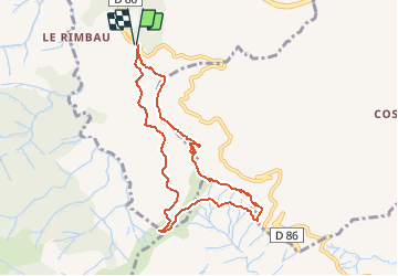

Length
8.5 km

Max alt
637 m

Uphill gradient
398 m
Km-Effort
13.9 km

Min alt
325 m

Downhill gradient
402 m
Boucle
Yes
Creation date :
2019-08-04 09:20:58.986
Updated on :
2020-01-31 20:30:46.107
--
Difficulty : Unknown

FREE GPS app for hiking
 SityTrail
IGN / Geographical institutes
SityTrail Plus
The world is yours!
About
Trail Walking of 8.5 km to be discovered at Occitania, Pyrénées-Orientales, Collioure. This trail is proposed by georgein.
Positioning
Country:
France
Region :
Occitania
Department/Province :
Pyrénées-Orientales
Municipality :
Collioure
Location:
Unknown
Start:(Dec)
Start:(UTM)
505359 ; 4705843 (31T) N.
Comments