


2017-10-23.gpx

georgein
User
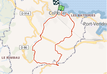

Length
8.8 km

Max alt
304 m

Uphill gradient
348 m
Km-Effort
13.5 km

Min alt
4 m

Downhill gradient
359 m
Boucle
No
Creation date :
2019-08-04 09:20:55.972
Updated on :
2020-01-31 20:30:41.129
--
Difficulty : Unknown

FREE GPS app for hiking
 SityTrail
IGN / Geographical institutes
SityTrail Plus
The world is yours!
About
Trail Walking of 8.8 km to be discovered at Occitania, Pyrénées-Orientales, Collioure. This trail is proposed by georgein.
Positioning
Country:
France
Region :
Occitania
Department/Province :
Pyrénées-Orientales
Municipality :
Collioure
Location:
Unknown
Start:(Dec)
Start:(UTM)
506798 ; 4707997 (31T) N.
Comments