Trail Mountain bike Maing - Nord - Galère Maingeoise 2011 (Maing) - Photo

Nord - Galère Maingeoise 2011 (Maing)

 Ticrob
Ticrob

User

© OpenStreetMap contributors
Length
Length
35 km
Max alt
Max alt
88 m
Uphill gradient
Uphill gradient
301 m
Km-Effort
Km-Effort  
39 km
Min alt
Min alt
20 m
Downhill gradient
Downhill gradient
301 m
Boucle
Boucle
Yes
Creation date :
2014-12-10 00:00:00.0
Updated on :
2014-12-10 00:00:00.0

(0 Reviews)

Mountain bike
Mountain bike
2h45
Difficulty : Medium

Scan this QR Code to open this trail in the SityTrail application

FREE GPS app for hiking

Logo SityTrail SityTrail

IGN / Geographical institutes

Download SityTrail from the App Store Download SityTrail from Google Play

Logo SityTrail SityTrail World

The world is yours!

Download SityTrail from the App Store Download SityTrail from Google Play Download SityTrail on Huawei AppGallery

About

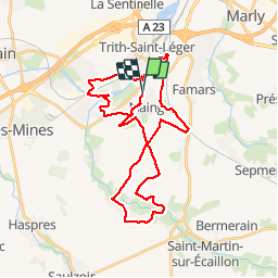
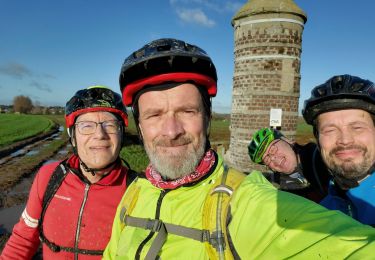
Trail Mountain bike of 35 km to be discovered at Hauts-de-France, Nord, Maing. This trail is proposed by Ticrob.

Description

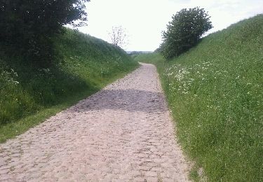
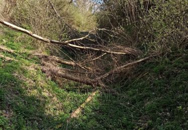
Dernière partie de trajet plus technique et physique avec petites montées et descentes abruptes.
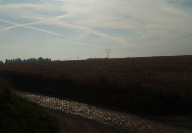
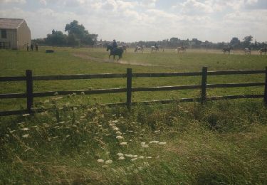
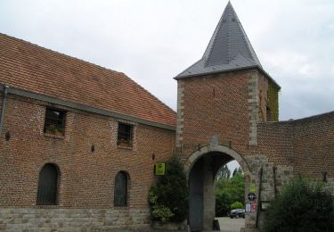
Parcours agréable avec quelques portions de pavés...

Elevation profile

Positioning

Country:
France
Region :
Hauts-de-France
Department/Province :
Nord
Municipality :
Maing
Location:
Unknown
Start:(Dec)
Start:(UTM)
534596 ; 5573566 (31U) N.

Trails nearby

Trail Walking Quérénaing - la querenaingeoise trace faite - Photo
Walking
papiou

Walking

Very easy
Quérénaing, Hauts-de-France, Nord, France
9.1 km | 10.2 km-effort
1h 33min
Yes
Trail Walking Hérin - Hérin, variante des 4 clochers - Photo
Walking
papiou

Walking

Easy
Hérin, Hauts-de-France, Nord, France
8.7 km | 9.2 km-effort
1h 58min
Yes
Trail Mountain bike Maing - boucle autour de Maing - Photo
Mountain bike
Obeone2264

Mountain bike

Medium
Maing, Hauts-de-France, Nord, France
16.5 km | 18.1 km-effort
2h 0min
Yes
Trail Walking Maing - Maing-circuit pas de boeuf, version 11km - Photo
Walking
papiou

Walking

Medium
Maing, Hauts-de-France, Nord, France
11.2 km | 12.5 km-effort
2h 32min
Yes
Trail Walking Aulnoy-lez-Valenciennes - La vallée de la Rhonelle - Aulnoy-lez-Valenciennes - Photo
Walking
tracegps

Walking

Medium
Aulnoy-lez-Valenciennes, Hauts-de-France, Nord, France
9.9 km | 11 km-effort
2h 30min
Yes
Trail Walking Verchain-Maugré - interclub du 16/4/23. 9 km - Photo
Walking
papiou

Walking

Easy
Verchain-Maugré, Hauts-de-France, Nord, France
9.2 km | 10.2 km-effort
2h 0min
Yes
Trail Mountain bike Marly - zette - Photo
Mountain bike
jdaviere

Mountain bike

Very difficult
Marly, Hauts-de-France, Nord, France
40 km | 45 km-effort
2h 11min
Yes
Trail Walking Valenciennes - Valenciennes artistes - Photo
Walking
arpenteur59

Walking

Easy
Valenciennes, Hauts-de-France, Nord, France
8.7 km | 9.5 km-effort
2h 25min
Yes
Trail Walking Quérénaing - Querenaing, rando Pascal 9 Km - Photo
Walking
papiou

Walking

Medium
Quérénaing, Hauts-de-France, Nord, France
9 km | 10.1 km-effort
2h 0min
Yes


Close
My subscriptions