Trail Walking Cheix-en-Retz - La Pierre tremblante - Photo
© OpenStreetMap contributors
Length
Length
11.2 km
Max alt
Max alt
26 m
Uphill gradient
Uphill gradient
70 m
Km-Effort
Km-Effort  
12.2 km
Min alt
Min alt
0 m
Downhill gradient
Downhill gradient
66 m
Boucle
Boucle
Yes
Creation date :
2018-04-17 12:17:00.118
Updated on :
2018-04-17 12:17:00.118

(0 Reviews)

Walking
Walking
2h40
Difficulty : Easy

Scan this QR Code to open this trail in the SityTrail application

FREE GPS app for hiking

Logo SityTrail SityTrail

IGN / Geographical institutes

Download SityTrail from the App Store Download SityTrail from Google Play

Logo SityTrail SityTrail World

The world is yours!

Download SityTrail from the App Store Download SityTrail from Google Play Download SityTrail on Huawei AppGallery

About

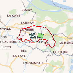
Trail Walking of 11.2 km to be discovered at Pays de la Loire, Loire-Atlantique, Cheix-en-Retz. This trail is proposed by neoroll44.

Description

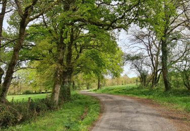
Entre bocage et bord du marais de l'Acheneau.
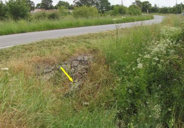
Bien balisé. Suivre balisage jaune et pancartes.

Elevation profile

Photos

Points of interest

Point of interest Cheix-en-Retz - la pierre tremblante - Photo
neoroll44
CHEIX-EN-RETZ 
Point of interest Cheix-en-Retz - Marais de Cheix - Photo
neoroll44
CHEIX-EN-RETZ 

Positioning

Country:
France
Region :
Pays de la Loire
Department/Province :
Loire-Atlantique
Municipality :
Cheix-en-Retz
Location:
Unknown
Start:(UTM)
589719 ; 5226002 (30T) N.

Trails nearby

Trail Bicycle tourism Le Pellerin - Activity - Photo
Bicycle tourism
GUIDE
jeanmarcMasson

Bicycle tourism

Very easy
(1)
Le Pellerin, Pays de la Loire, Loire-Atlantique, France
57 km | 62 km-effort
6h 0min
No
Trail Walking Rouans - Le Grand Chemin - Photo
Walking
Mitche44

Walking

Medium
(1)
Rouans, Pays de la Loire, Loire-Atlantique, France
21 km | 23 km-effort
5h 12min
Yes
Trail On foot Rouans - Le Grand Chemin - Photo
On foot
PRO

On foot

Medium
Rouans, Pays de la Loire, Loire-Atlantique, France
21 km | 23 km-effort
5h 17min
Yes
Trail Walking Couëron - boucle lac de beaulieu - Photo
Walking
Emilie Charrier

Walking

Very difficult
(1)
Couëron, Pays de la Loire, Loire-Atlantique, France
17.5 km | 19.6 km-effort
4h 34min
Yes
Trail Walking Le Pellerin - Canal de la Martiniere - Photo
Walking
michel.blin

Walking

Medium
Le Pellerin, Pays de la Loire, Loire-Atlantique, France
6.5 km | 6.9 km-effort
1h 48min
Yes
Trail Bicycle tourism Le Pellerin - Le Pèlerin - La plaine sur mer - 57 km - Photo
Bicycle tourism
GUIDE
jeanmarcMasson

Bicycle tourism

Very difficult
Le Pellerin, Pays de la Loire, Loire-Atlantique, France
57 km | 61 km-effort
4h 4min
No
Trail Walking Le Pellerin - Boucle autour de Le Pèlerin - Photo
Walking
phimar_2612

Walking

Medium
Le Pellerin, Pays de la Loire, Loire-Atlantique, France
12.4 km | 13.5 km-effort
3h 5min
Yes
Trail Walking Couëron - Tour étang Bernard par les marais  - Photo
Walking
Emilie Charrier

Walking

Difficult
Couëron, Pays de la Loire, Loire-Atlantique, France
11.4 km | 12.3 km-effort
2h 47min
Yes
Trail Walking Rouans - Acheneau par Rouans - Photo
Walking
LeonEvain

Walking

Easy
Rouans, Pays de la Loire, Loire-Atlantique, France
13.8 km | 15.1 km-effort
3h 34min
Yes


Close
My subscriptions