Trail Other activity Bandrélé - kayak a sakouli - Photo

kayak a sakouli

 peintrev
peintrev

User

© OpenStreetMap contributors
Length
Length
3.9 km
Max alt
Max alt
48 m
Uphill gradient
Uphill gradient
34 m
Km-Effort
Km-Effort  
4.4 km
Min alt
Min alt
0 m
Downhill gradient
Downhill gradient
58 m
Boucle
Boucle
No
Creation date :
2018-04-17 13:25:15.944
Updated on :
2018-04-17 13:25:15.944

(1 Reviews)

Other activity
Other activity
51m
Difficulty : Easy

Scan this QR Code to open this trail in the SityTrail application

FREE GPS app for hiking

Logo SityTrail SityTrail

IGN / Geographical institutes

Download SityTrail from the App Store Download SityTrail from Google Play

Logo SityTrail SityTrail World

The world is yours!

Download SityTrail from the App Store Download SityTrail from Google Play Download SityTrail on Huawei AppGallery

About

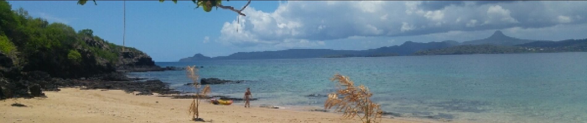
Trail Other activity of 3.9 km to be discovered at Mayotte, Unknown, Bandrélé. This trail is proposed by peintrev.

Elevation profile

Photos

Positioning

Country:
France
Region :
Mayotte
Department/Province :
Unknown
Municipality :
Bandrélé
Location:
Unknown
Start:(UTM)
525402 ; 8574166 (38L) S.

Comments

Please log in to post a review or rate the element


très belle balade en kayak, plages de rêve sur l'îlot. ??


Trails nearby

Trail Motor Bandrélé - Mayotte 11042019 - Photo
Motor
Roulland

Motor

Easy
Bandrélé, Mayotte, Unknown, France
3.5 km | 3.8 km-effort
1h 39min
No


Close
My subscriptions