


Grand Paradis - J4

saphile
User
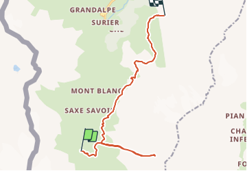

Length
14.1 km

Max alt
3069 m

Uphill gradient
1108 m
Km-Effort
29 km

Min alt
2277 m

Downhill gradient
1027 m
Boucle
No
Creation date :
2018-04-17 14:32:38.02
Updated on :
2018-04-17 14:32:38.02
5h52
Difficulty : Very difficult

FREE GPS app for hiking
 SityTrail
IGN / Geographical institutes
SityTrail Plus
The world is yours!
About
Trail Walking of 14.1 km to be discovered at Aosta Valley, Unknown, Valgrisenche. This trail is proposed by saphile.
Description
Grand Paradis 2018 - J4

Positioning
Country:
Italy
Region :
Aosta Valley
Department/Province :
Unknown
Municipality :
Valgrisenche
Location:
Unknown
Start:(Dec)
Start:(UTM)
345260 ; 5044949 (32T) N.
Comments